|
search place name
|
||
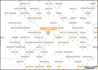
Bản Chao (Sơn La, Vietnam)Bản Chao is a town in the Sơn La region of Vietnam. An overview map of the region around Bản Chao is displayed below.
regional and 3d topo map of Bản Chao, Vietnam ::
Bản Chao airports ::
The nearest airport is LPQ - Luang Prabang Luang Phabang Intl, located 243.7 km south west of Bản Chao.
Nearby towns ::
Bản Pu (0.0km north) //
Ngàm Tựa (1.7km west) //
Bản Cuôi (1.9km north) //
Ðọng Cu (1.7km east) //
Bản Sẳng (2.5km south west) //
Nong Cạn (2.5km north west) //
Bản Na Sen (2.5km south east) //
Bản Na Cáu (2.5km north east) //
Bản Mùa (3.4km west) //
Nong Sùng (3.7km south) //
Bản Na Ho (3.4km east) //
Bản Na Viêng (3.4km east) //
Noọng Lay (3.9km south west) //
Bản Thúm (4.1km south west) //
Bản Lê (4.1km south west) //
Bản Min (3.9km north west) //
Bản Tam (3.9km north west) //
Nà Biềng (3.9km south east) //
Bản Xuôi (3.9km south east) //
Bản Long Keo (3.9km south east) //
Bản Xắt (4.1km north east) //
Bản Na Lân (3.9km north east) //
Bản Xen Tô (5.1km south west) //
Bản Bố (5.1km south east) //
Bản Huội Xất (5.1km north east) //
Bản Nông Giằng (5.2km west) //
Bản Tưm (5.2km east) //
Bản Nhốc (5.2km east) //
Bản Ðap Tong (5.2km east) //
[all distances 'as the bird flies' and approximate] 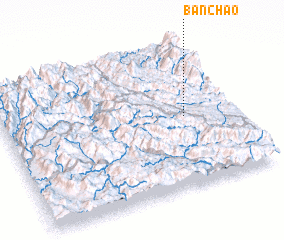 Places with similar names to Bản Chao, Vietnam ::
// Ben Aouich (MA)
// Beni Aïchi (MA)
// Benicia (US)
// Bench (US)
// Ban Ao Cho (TH)
// Ban Chae (TH)
// Ban Chai (TH)
// Ban Chi (TH)
// Ban Chia (TH)
// Ban Chia (TH)
Disclaimer :: Information on this page comes without warranty of any kind |
||
|
Where is Bản Chao? Elevation and coordinates ::
Latitude (lat): 21°29'0"N Longitude (lon): 103°47'0"E
Elevation (approx.): 288m (map arrows pan, magnifying glasses zoom) |
||
|
Visiting Bản Chao? Hotel/Accommodation ::
Book a hotel in Bản Chao Travel Guide ::
Buy a travel guide for Vietnam rental cars ::
car rental offers GPS waypoint ::
download a GPX waypoint (PoI) of Bản Chao for your GPS receiver
|
||