|
search place name
|
||
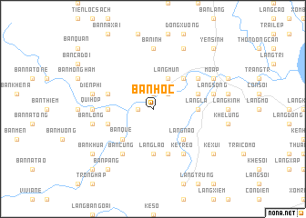
Bản Hốc (Vietnam)Bản Hốc is a town in Vietnam. An overview map of the region around Bản Hốc is displayed below.
regional and 3d topo map of Bản Hốc, Vietnam ::
Bản Hốc airports ::
The nearest airport is HAN - Hanoi Noibai Intl, located 219.7 km north of Bản Hốc.
Nearby towns ::
Thọ Vực (1.9km north) //
Bản Ðiếm (1.7km west) //
Làng Giua (2.5km north east) //
Làng Cốc (2.5km north east) //
Kẻ Soi Trên (2.5km north east) //
Làng Mắm (2.5km north east) //
Ðõ Ấp (2.5km north east) //
Làng Mun (4.1km north east) //
Làng Chu (4.1km north east) //
Kẻ Soi Dưới (4.1km north east) //
Làng Chao (5.1km north east) //
Làng Nào (5.1km south east) //
Bản Qué (5.1km south west) //
Làng La (5.2km east) //
Làng Láo (5.6km south) //
Kẻ Mo (5.6km south) //
Bản Ðồn (5.2km west) //
Làng Giộn (5.6km east) //
Kẻ Sồng (5.8km south) //
Bản Na Cơn (5.6km west) //
Bản Coi (5.6km west) //
Kẻ Trèo (6.6km south east) //
Làng Ðồng (6.4km north east) //
Làng Ðồng Bọ (6.4km north east) //
Bản Cung (6.6km south west) //
Bản Ken (7.4km north) //
Bản Ình (7.4km north) //
Bản Cut (7.4km north) //
Bản Món (7.0km west) //
[all distances 'as the bird flies' and approximate] 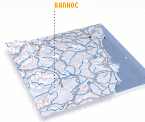 Places with similar names to Bản Hốc, Vietnam ::
// Ban Hok (TH)
// Ban Hok (TH)
// Ban Huai (2) (TH)
// Ban Huai Kaeo (TH)
// Ban Huai Kaeo (TH)
// Ban Huai Kaeo (TH)
// Ban Huai Kaeo (TH)
// Ban Huai Kaeo (TH)
// Ban Huai Kaeo (TH)
// Ban Huai Kaeo (TH)
Disclaimer :: Information on this page comes without warranty of any kind |
||
|
Where is Bản Hốc? Elevation and coordinates ::
Latitude (lat): 19°19'0"N Longitude (lon): 105°13'0"E
Elevation (approx.): 77m (map arrows pan, magnifying glasses zoom) |
||
|
Visiting Bản Hốc? Hotel/Accommodation ::
Book a hotel in Bản Hốc Travel Guide ::
Buy a travel guide for Vietnam rental cars ::
car rental offers GPS waypoint ::
download a GPX waypoint (PoI) of Bản Hốc for your GPS receiver
|
||