|
search place name
|
||
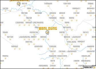
Bản Loung (Bắc Thái, Vietnam)Bản Loung is a town in the Bắc Thái region of Vietnam. An overview map of the region around Bản Loung is displayed below.
regional and 3d topo map of Bản Loung, Vietnam ::
Bản Loung airports ::
The nearest airport is HAN - Hanoi Noibai Intl, located 126.9 km south of Bản Loung.
Nearby towns ::
Na Nao (1.9km north) //
Pien Phuong (1.9km south) //
Bản Ho (2.5km south west) //
Nam Linh (3.9km north west) //
Kouei Hoan (3.9km south west) //
Pac Phuong (5.0km north west) //
Na Fac (5.1km east) //
Na Buo (5.6km south) //
Na Tam (5.6km south) //
Pieng Cam (5.1km west) //
Ta Ngoa (5.8km south) //
Tong Moc (5.8km north) //
Pa Nat (5.5km west) //
Hoan Kao (6.5km south west) //
Na Pey (6.3km north west) //
Na Dong (6.3km south west) //
Coue Zueuil (7.4km north) //
Kouei Pouc (6.9km east) //
Hạ Hiệu (7.6km north) //
Coc Quan (7.1km west) //
Na Young (7.1km east) //
Tie Cot (7.6km south) //
Bản Kai (7.1km east) //
Na Kei (7.6km north east) //
Coue Mi (7.8km north west) //
Na Muoy (7.8km north west) //
Bản Han (8.2km north west) //
Nam Tac (7.8km south west) //
Na Pa (7.8km north east) //
[all distances 'as the bird flies' and approximate] 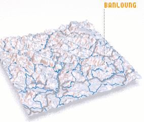 Places with similar names to Bản Loung, Vietnam ::
// Ban Alang (TH)
// Ban Ao Ling (TH)
// Ban Laeng (TH)
// Ban Laeng (TH)
// Ban Lai Ngao (TH)
// Ban Lang (TH)
// Ban Lan Nok (TH)
// Ban Loeng (TH)
// Ban Long (TH)
// Ban Long O (TH)
Disclaimer :: Information on this page comes without warranty of any kind |
||
|
Where is Bản Loung? Elevation and coordinates ::
Latitude (lat): 22°22'0"N Longitude (lon): 105°50'0"E
Elevation (approx.): 293m (map arrows pan, magnifying glasses zoom) |
||
|
Visiting Bản Loung? Hotel/Accommodation ::
Book a hotel in Bản Loung Travel Guide ::
Buy a travel guide for Vietnam rental cars ::
car rental offers GPS waypoint ::
download a GPX waypoint (PoI) of Bản Loung for your GPS receiver
|
||