|
search place name
|
||
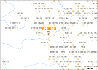
Bản Pen (Sơn La, Vietnam)Bản Pen is a town in the Sơn La region of Vietnam. An overview map of the region around Bản Pen is displayed below.
regional and 3d topo map of Bản Pen, Vietnam ::
Bản Pen airports ::
The nearest airport is LPQ - Luang Prabang Luang Phabang Intl, located 232.4 km south west of Bản Pen.
Nearby towns ::
Bản Pa (NaNkm north) //
Bản Bua (NaNkm north) //
Bản Na Cang (1.9km north) //
Bản Na Ty (1.9km north) //
Bản Chiêng Lý (1.9km north) //
Bản Mon (1.9km north) //
Bản Cha (1.9km south) //
Bản Lua (1.7km east) //
Bản Thốm (1.7km east) //
Bản Bốn (1.7km west) //
Bản Pung (1.9km south) //
Bản Phe (1.7km east) //
Bản Na Giom (1.9km south) //
Bản Hương (2.5km north west) //
Bản Hua Na (2.5km north east) //
Bản Na Ca (2.5km north west) //
Thuận Châu (2.5km north west) //
Bản Na Hay (2.5km north east) //
Bản Gie (3.7km north) //
Bản Long Ho (3.5km west) //
Bản Yuc (3.5km west) //
Bản Long Hệ (3.5km west) //
Bản Na Cụ (3.7km south) //
Bản Na Hat (3.7km south) //
Bản Thẩm (3.9km north east) //
Bản Vàng Mận (3.9km north west) //
Bản Gia (4.1km north west) //
Bản Nậm Ha (4.1km north east) //
Bản Phạ (4.1km south west) //
[all distances 'as the bird flies' and approximate]  Places with similar names to Bản Pen, Vietnam ::
// Binapon (PH)
// Ban Na Pan (TH)
// Ban Na Pan (TH)
// Ban Na Po Nua (TH)
// Ban Na Pun (TH)
// Ban Na Pun (TH)
// Ban Paen (TH)
// Ban Paen (TH)
// Ban Paen (TH)
// Ban Pan (TH)
Disclaimer :: Information on this page comes without warranty of any kind |
||
|
Where is Bản Pen? Elevation and coordinates ::
Latitude (lat): 21°25'0"N Longitude (lon): 103°42'0"E
Elevation (approx.): 719m (map arrows pan, magnifying glasses zoom) |
||
|
Visiting Bản Pen? Hotel/Accommodation ::
Book a hotel in Bản Pen Travel Guide ::
Buy a travel guide for Vietnam rental cars ::
car rental offers GPS waypoint ::
download a GPX waypoint (PoI) of Bản Pen for your GPS receiver
|
||