|
search place name
|
||
Ban Suk Hdrah (Ðắc Lắk, Vietnam)Ban Suk Hdrah is a town in the Ðắc Lắk region of Vietnam. An overview map of the region around Ban Suk Hdrah is displayed below.
regional and 3d topo map of Ban Suk Hdrah, Vietnam ::

Ban Suk Hdrah airports ::
The nearest airport is NHA - Nhatrang, located 135.5 km south east of Ban Suk Hdrah.
Nearby towns ::
Ban Kmu (1) (1.9km south) //
Ban Suk Gâu (2.6km north west) //
Ban Kay (2.6km south east) //
Ban Diuot (4.1km south west) //
Ban Ktla (4.1km south west) //
Ban Dang (4.1km south east) //
Ban Kmu (2) (5.2km south west) //
Ban Cô Ama Mnio (1) (5.2km north east) //
Ban Kdrao (5.7km west) //
Ban Kniet (5.8km north) //
Ban Ioh (5.7km east) //
Ban Yun (5.7km east) //
Ban Toh (6.6km south east) //
Ban K'dro (7.2km west) //
Ban Drun (2) (7.4km north) //
Ban Krieng (7.4km south) //
Ban Drun (3) (7.6km north) //
Ban Drun (1) (7.6km north) //
Ban Gir (7.6km south) //
Ban Cô (2) (8.2km north east) //
Ban Sor (8.1km north east) //
Ban Dhung (8.1km north east) //
Ban Yun Roué (8.1km south east) //
Ban Magam (9.1km north east) //
[all distances 'as the bird flies' and approximate] 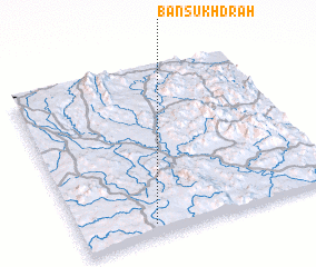 Places with similar names to Ban Suk Hdrah, Vietnam :: Disclaimer :: Information on this page comes without warranty of any kind |
||
|
Where is Ban Suk Hdrah? Elevation and coordinates ::
Latitude (lat): 13°4'0"N Longitude (lon): 108°17'0"E
Elevation (approx.): 804m (map arrows pan, magnifying glasses zoom) |
||
|
Visiting Ban Suk Hdrah? Hotel/Accommodation ::
Book a hotel in Ban Suk Hdrah Travel Guide ::
Buy a travel guide for Vietnam rental cars ::
car rental offers GPS waypoint ::
download a GPX waypoint (PoI) of Ban Suk Hdrah for your GPS receiver
|
||