|
search place name
|
||
Bản Sung Quan (Lai Châu, Vietnam)Bản Sung Quan is a town in the Lai Châu region of Vietnam. An overview map of the region around Bản Sung Quan is displayed below.
regional and 3d topo map of Bản Sung Quan, Vietnam ::
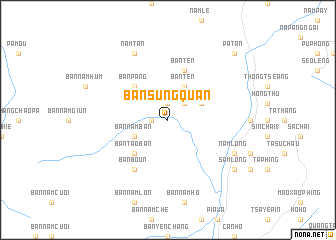
Nearby towns ::
Bản Nam Ban (1.7km west) //
Bản Pang (1.9km north) //
Bản Sao (2.5km north east) //
Bản Ten (4.1km north east) //
Bản Sao (3.9km north east) //
Bản Nam Ban (3.9km south west) //
Bản Tao Ban (5.0km south west) //
Bản Pang (5.0km north west) //
Bản Ten (5.8km north) //
Bản Boun (6.5km south west) //
Nam Lông (7.8km south east) //
Nam Tan (8.2km north west) //
Khu Chù Pin (8.8km south east) //
Sam Lông (8.8km south east) //
Pả Tan (10.1km north east) //
[all distances 'as the bird flies' and approximate] 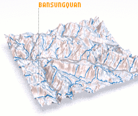 Places with similar names to Bản Sung Quan, Vietnam ::
Disclaimer :: Information on this page comes without warranty of any kind |
||
|
Where is Bản Sung Quan? Elevation and coordinates ::
Latitude (lat): 22°24'0"N Longitude (lon): 103°7'0"E
Elevation (approx.): 737m (map arrows pan, magnifying glasses zoom) |
||
|
Visiting Bản Sung Quan? Hotel/Accommodation ::
Book a hotel in Bản Sung Quan Travel Guide ::
Buy a travel guide for Vietnam rental cars ::
car rental offers GPS waypoint ::
download a GPX waypoint (PoI) of Bản Sung Quan for your GPS receiver
|
||