|
search place name
|
||
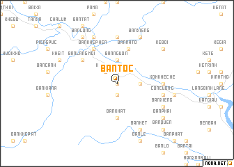
Bản Toc (Vietnam)Bản Toc is a town in Vietnam. An overview map of the region around Bản Toc is displayed below.
regional and 3d topo map of Bản Toc, Vietnam ::
Bản Toc airports ::
The nearest airport is SNO - Sakon Nakhon, located 218.8 km south of Bản Toc.
Nearby towns ::
Bản Ðình (0.0km north) //
Bản Khe Chai (0.0km north) //
Bản Ðôc (1.9km south) //
Khẻ Tat (2.6km north west) //
Bản Chù Nù (3.7km north) //
Bản Nguòn (3.7km north) //
Bản Khe Rạn (3.5km east) //
Bản Khat (5.6km south) //
Bản Na Tợ (5.8km north) //
Bản Ðôn Phúc (5.8km north) //
Bản Khe Phen (6.6km north west) //
Bản Lang Mới (6.4km north west) //
Bản Pai Quanh (6.4km north west) //
Xóm Khe Chè (7.0km east) //
Bản Khe Chè (7.0km east) //
Bản Ngon (7.4km north) //
Xóm Ðồn Ðiến (7.0km east) //
Bản Na Phả (7.2km east) //
Con Cuông (7.2km east) //
Bản Xiêng (7.9km south east) //
Bản Cồng (8.2km north west) //
Bản Ðá Nổi (8.2km north west) //
Bản Xiêng (8.2km north east) //
Bản Mét (8.2km south east) //
Bản Pài (8.2km north east) //
Kẻ Bỏi (8.9km north east) //
Bản Phại (8.9km south east) //
Bản Long (9.1km north west) //
Bản Quen (10.2km south east) //
[all distances 'as the bird flies' and approximate] 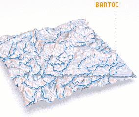 Places with similar names to Bản Toc, Vietnam ::
Disclaimer :: Information on this page comes without warranty of any kind |
||
|
Where is Bản Toc? Elevation and coordinates ::
Latitude (lat): 19°3'0"N Longitude (lon): 104°50'0"E
Elevation (approx.): 87m (map arrows pan, magnifying glasses zoom) |
||
|
Visiting Bản Toc? Hotel/Accommodation ::
Book a hotel in Bản Toc Travel Guide ::
Buy a travel guide for Vietnam rental cars ::
car rental offers GPS waypoint ::
download a GPX waypoint (PoI) of Bản Toc for your GPS receiver
|
||