|
search place name
|
||
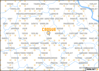
Cao Duệ (Hải Hưng, Vietnam)Cao Duệ is a town in the Hải Hưng region of Vietnam. An overview map of the region around Cao Duệ is displayed below.
regional and 3d topo map of Cao Duệ, Vietnam ::
Cao Duệ airports ::
The nearest airport is HAN - Hanoi Noibai Intl, located 65.5 km north west of Cao Duệ.
Other airports nearby include NNG - Nanning Wuxu (282.2 km north east), Nearby towns ::
Quỳnh Côi Hạ (1.9km north) //
Vô Hối (1.9km south) //
Hàn Lam (2.5km north west) //
Phượng Hoàng (2.5km south east) //
Chỉ Trung (2.5km south west) //
Hậu Bổng (2.5km south east) //
Thọ Trương (3.5km west) //
Hoàng Du (3.5km east) //
Gia Cốc (3.7km south) //
Thòng Dồ (3.9km north east) //
An Cư (3.9km south east) //
Phạm Lâm (4.1km north west) //
Cụ Trì (4.1km south east) //
Yèn Khoái (4.1km south west) //
Gia Cốc (4.1km south west) //
Mai Dông (5.1km south east) //
Ðồng Tai (5.2km east) //
Yến Lâu (5.2km west) //
Chung Thon (5.6km south) //
Ðông Thôn (5.6km north) //
Kim Húc (5.5km east) //
Phú Mễ (5.8km south) //
Bằng Cách (6.4km north west) //
Ðoàn Bai (6.4km north east) //
Ðình Tổ (6.4km north west) //
Chúc Khê (6.6km north east) //
Hòa Loan (6.6km north west) //
Bùi Hòa (6.6km south east) //
Bùi Xá (6.6km north west) //
[all distances 'as the bird flies' and approximate]  Places with similar names to Cao Duệ, Vietnam ::
Disclaimer :: Information on this page comes without warranty of any kind |
||
|
Where is Cao Duệ? Elevation and coordinates ::
Latitude (lat): 20°48'0"N Longitude (lon): 106°15'0"E
Elevation (approx.): 3m (map arrows pan, magnifying glasses zoom) |
||
|
Visiting Cao Duệ? Hotel/Accommodation ::
Book a hotel in Cao Duệ Travel Guide ::
Buy a travel guide for Vietnam rental cars ::
car rental offers GPS waypoint ::
download a GPX waypoint (PoI) of Cao Duệ for your GPS receiver
|
||