|
search place name
|
||
Cho Rong (Quảng Nam-Ðà Nẵng, Vietnam)Cho Rong is a town in the Quảng Nam-Ðà Nẵng region of Vietnam. An overview map of the region around Cho Rong is displayed below.
regional and 3d topo map of Cho Rong, Vietnam ::

Cho Rong airports ::
The nearest airport is DAD - Danang Intl, located 41.5 km east of Cho Rong.
Nearby towns ::
Bôlô Sơn (2.6km south west) //
Bôlô Hiên (2.6km south west) //
Ba Lien (4.0km south east) //
Bôlô Daô (4.0km south west) //
Bôlô Young (4.0km south west) //
Ta Ui (5.1km south east) //
Bouk (5.3km west) //
Bang Young (5.8km south) //
Ken (6.6km south west) //
Ben (6.6km south west) //
Bang (7.6km south) //
Viêu (7.6km south) //
Soung (7.4km east) //
Ngât Trên (7.6km south) //
Phù Bao (1) (8.0km south east) //
Tu Nuk (8.2km south west) //
Xa Diêm (8.0km north east) //
Toă (9.1km south west) //
Lounh (9.0km south west) //
[all distances 'as the bird flies' and approximate] 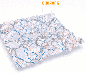 Places with similar names to Cho Rong, Vietnam ::
Disclaimer :: Information on this page comes without warranty of any kind |
||
|
Where is Cho Rong? Elevation and coordinates ::
Latitude (lat): 15°59'0"N Longitude (lon): 107°49'0"E
Elevation (approx.): 390m (map arrows pan, magnifying glasses zoom) |
||
|
Visiting Cho Rong? Hotel/Accommodation ::
Book a hotel in Cho Rong Travel Guide ::
Buy a travel guide for Vietnam rental cars ::
car rental offers GPS waypoint ::
download a GPX waypoint (PoI) of Cho Rong for your GPS receiver
|
||