|
search place name
|
||
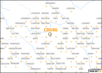
Cô Giâu (Cao Bằng, Vietnam)Cô Giâu is a town in the Cao Bằng region of Vietnam. An overview map of the region around Cô Giâu is displayed below.
regional and 3d topo map of Cô Giâu, Vietnam ::
Cô Giâu airports ::
The nearest airport is NNG - Nanning Wuxu, located 170.2 km east of Cô Giâu.
Other airports nearby include HAN - Hanoi Noibai Intl (193.6 km south west), Nearby towns ::
Tả Than (1.7km west) //
Trùng Khánh (1.7km west) //
Hảo Lể (1.7km west) //
Co Nghĩu (1.9km south) //
Lũng Piên (1.9km south) //
Khua Khac (1.7km east) //
Pác Rảo (2.5km south west) //
Giôc Khăm (4.1km south west) //
Thua Cẩu (4.1km south west) //
Kéo Nôc (4.1km south east) //
Nặm Thúm (4.1km north west) //
Lũng Kít (4.1km north west) //
Knau Gat (3.9km south east) //
Nà Gach (3.9km north east) //
Pô Ðon (5.0km south east) //
Làng Muổn (5.1km west) //
Phai Pán (5.6km north) //
Bản Piên (5.1km east) //
Co Bay (5.1km east) //
Pò Có (5.4km west) //
Nà Chang (5.8km north) //
Lũng Vào Làng (5.8km north) //
Pò Gài (5.4km east) //
Pác Khuổi (5.4km west) //
Giôc Giùng (5.8km north) //
Tả Pít (5.8km north) //
Tả Mẩn (5.4km east) //
Lũng Ỏ (6.5km north west) //
Co Vường (6.5km south west) //
[all distances 'as the bird flies' and approximate] 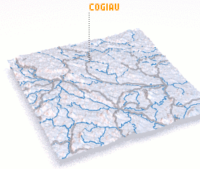 Places with similar names to Cô Giâu, Vietnam ::
Disclaimer :: Information on this page comes without warranty of any kind |
||
|
Where is Cô Giâu? Elevation and coordinates ::
Latitude (lat): 22°50'0"N Longitude (lon): 106°32'0"E
Elevation (approx.): 535m (map arrows pan, magnifying glasses zoom) |
||
|
Visiting Cô Giâu? Hotel/Accommodation ::
Book a hotel in Cô Giâu Travel Guide ::
Buy a travel guide for Vietnam rental cars ::
car rental offers GPS waypoint ::
download a GPX waypoint (PoI) of Cô Giâu for your GPS receiver
|
||