|
search place name
|
||
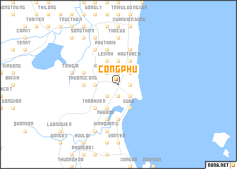
Cộng Phú (Thanh Hóa, Vietnam)Cộng Phú is a town in the Thanh Hóa region of Vietnam. An overview map of the region around Cộng Phú is displayed below.
regional and 3d topo map of Cộng Phú, Vietnam ::
Cộng Phú airports ::
The nearest airport is HAN - Hanoi Noibai Intl, located 196.1 km north of Cộng Phú.
Nearby towns ::
Như Xuân (1.9km south) //
Hậu Hưng (1.9km north) //
Lê Vinh (1.7km east) //
Phu Quật (2.5km south west) //
Nổ Giáp (2.5km south west) //
Khánh Vân (2.5km north west) //
Ngoai Hải (2.5km south east) //
Phù Nhẫn (2.5km south east) //
Ba Lang (2.5km south east) //
Khoa Giáp (2.5km south east) //
Hanh Lợi (2.5km north east) //
Thọ Quan (3.5km west) //
Nhân Mỹ (3.5km west) //
Thổ Sơn (3.5km west) //
Hào Môn Trung (1) (3.7km north) //
Hâu Ðại (3.7km north) //
Ðự Quần (4.1km south west) //
Lê Vinh (4.1km north west) //
Du Ðộ (4.1km south east) //
Hào Môn Ðông (4.1km north east) //
Hậu Thạch (4.1km north east) //
Ðại Thủy (5.1km south west) //
Thanh Vân (5.1km south west) //
Sa Thôn (5.1km south west) //
Qui Mỹ (5.1km south west) //
Thượng Công (5.2km west) //
Du Xuyên (5.6km south) //
Phủ Thái (1) (5.8km north) //
Như Áng (5.8km south) //
[all distances 'as the bird flies' and approximate]  Places with similar names to Cộng Phú, Vietnam ::
Disclaimer :: Information on this page comes without warranty of any kind |
||
|
Where is Cộng Phú? Elevation and coordinates ::
Latitude (lat): 19°27'0"N Longitude (lon): 105°47'0"E
Elevation (approx.): 8m (map arrows pan, magnifying glasses zoom) |
||
|
Visiting Cộng Phú? Hotel/Accommodation ::
Book a hotel in Cộng Phú Travel Guide ::
Buy a travel guide for Vietnam rental cars ::
car rental offers GPS waypoint ::
download a GPX waypoint (PoI) of Cộng Phú for your GPS receiver
|
||