|
search place name
|
||
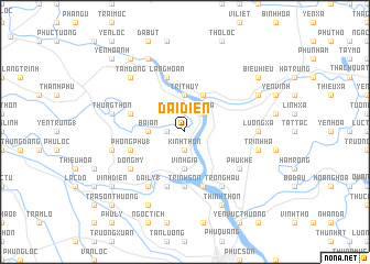
Ðại Diền (Thanh Hóa, Vietnam)Ðại Diền is a town in the Thanh Hóa region of Vietnam. An overview map of the region around Ðại Diền is displayed below.
regional and 3d topo map of Ðại Diền, Vietnam ::
Ðại Diền airports ::
The nearest airport is HAN - Hanoi Noibai Intl, located 142.7 km north of Ðại Diền.
Nearby towns ::
Kinh Thôn (1.9km south) //
Hùng Thôn (1.7km west) //
Hải Quật (1.7km west) //
Ða Phúc (2.5km north east) //
Trà La (2.5km north east) //
Phong Mục (2.5km north east) //
Bái Ân (3.5km west) //
Vĩnh Gia (3.7km south) //
Nga Phú (3.7km south) //
Trí Thủy (3.7km north) //
Ngọc Son (4.1km north east) //
Trinh Sơn (5.6km south) //
Doanh Xá (5.6km south) //
Bắc Bằng (5.6km south) //
Phong Phú (1) (5.5km west) //
Mai Trung (5.5km west) //
Quản Xá (5.8km south) //
Dương Xá (5.8km south) //
Làng Hoàn (5.8km north) //
Quì Chủ (6.6km south east) //
Trông Hậu (6.6km south east) //
Nhân Vuc (6.6km south east) //
Ðại Lý (1) (6.6km south west) //
Phú Khê (6.4km south east) //
Ðồng Mỹ (6.4km south west) //
Lương Xá (7.0km east) //
Nghia Phú (7.2km east) //
Nghia Trang (7.2km east) //
Ngưỡng Ðưc (7.2km west) //
[all distances 'as the bird flies' and approximate] 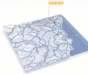 Places with similar names to Ðại Diền, Vietnam ::
Disclaimer :: Information on this page comes without warranty of any kind |
||
|
Where is Ðại Diền? Elevation and coordinates ::
Latitude (lat): 19°56'0"N Longitude (lon): 105°45'0"E
Elevation (approx.): 8m (map arrows pan, magnifying glasses zoom) |
||
|
Visiting Ðại Diền? Hotel/Accommodation ::
Book a hotel in Ðại Diền Travel Guide ::
Buy a travel guide for Vietnam rental cars ::
car rental offers GPS waypoint ::
download a GPX waypoint (PoI) of Ðại Diền for your GPS receiver
|
||