|
search place name
|
||
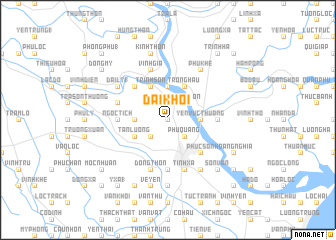
Ðại Khối (Thanh Hóa, Vietnam)Ðại Khối is a town in the Thanh Hóa region of Vietnam. An overview map of the region around Ðại Khối is displayed below.
regional and 3d topo map of Ðại Khối, Vietnam ::
Ðại Khối airports ::
The nearest airport is HAN - Hanoi Noibai Intl, located 151.9 km north of Ðại Khối.
Nearby towns ::
Ðộng Sơn (0.0km north) //
Thinh Thon (2.5km north east) //
Ðông Tac (2.5km south east) //
Phúc Sơn (2.5km south east) //
Phù Quang (2.5km south east) //
Bản Nguyen (2.5km south west) //
Phượng Ðình (3.5km east) //
Yên Vực Thượng (3.5km east) //
Dương Xá (3.7km north) //
Bai Giao (3.5km west) //
Nhân Vuc (4.1km north east) //
Trông Hậu (4.1km north east) //
Quì Chủ (4.1km north east) //
Trinh Sơn (4.1km north west) //
Bắc Bằng (4.1km north west) //
Doanh Xá (4.1km north west) //
Tân Lương (3.9km south west) //
Phúc Sơn (5.1km south east) //
Bao Noi (5.1km south east) //
Quản Xá (5.1km north west) //
Quan Nội (5.2km east) //
Ngoc Tich (5.2km west) //
Ðại Bối (5.2km west) //
Nhuệ Thon (5.6km south) //
Thanh Hóa (5.6km south) //
Tinh Xa (5.8km south) //
Ðắc Châu (5.5km west) //
Tòng Tân Nội (5.5km west) //
Nga Phú (5.8km north) //
[all distances 'as the bird flies' and approximate] 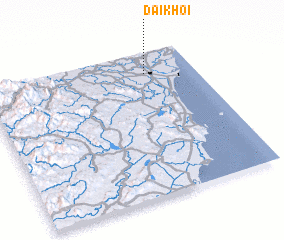 Places with similar names to Ðại Khối, Vietnam ::
Disclaimer :: Information on this page comes without warranty of any kind |
||
|
Where is Ðại Khối? Elevation and coordinates ::
Latitude (lat): 19°51'0"N Longitude (lon): 105°46'0"E
Elevation (approx.): 6m (map arrows pan, magnifying glasses zoom) |
||
|
Visiting Ðại Khối? Hotel/Accommodation ::
Book a hotel in Ðại Khối Travel Guide ::
Buy a travel guide for Vietnam rental cars ::
car rental offers GPS waypoint ::
download a GPX waypoint (PoI) of Ðại Khối for your GPS receiver
|
||