|
search place name
|
||
Ðàng Ðế (Vietnam)Ðàng Ðế is a town in Vietnam. An overview map of the region around Ðàng Ðế is displayed below.
regional and 3d topo map of Ðàng Ðế, Vietnam ::

Ðàng Ðế airports ::
The nearest airport is ZVK - Savannakhet, located 220.3 km south west of Ðàng Ðế.
Other airports nearby include DAD - Danang Intl (258.9 km south east), Nearby towns ::
Bầu Khê (1.8km east) //
Gianh Môn (2.6km north east) //
Quảng Khê (2.6km north east) //
Thanh Hà (2.6km north east) //
Trà Sơn (3.7km north) //
Xóm Quan (3.7km north) //
Cựu Ðình (4.1km north east) //
Mỹ Hòa Thượng (4.1km north west) //
Cao Hạ (4.0km north west) //
Van Phú (5.1km north west) //
Xóm Cồn (5.6km south) //
Hy Duyệt (5.8km south) //
Diên Phước (5.8km north) //
Xóm Làng (5.8km south) //
Xóm Ngan (6.6km south east) //
Lý Hòa (6.5km south east) //
Thanh Yến (6.5km south east) //
Thổ Ngọa (6.6km north west) //
Diên Lộc (6.6km south west) //
Thuận Bài (6.6km north west) //
Tân Ðình (6.5km north west) //
Xóm Mít (7.4km south) //
Phú Lể (7.6km south) //
Cao Thượng (7.3km west) //
Thợ Ðơn (7.6km north) //
Quảng Trach (7.6km north) //
Xóm Xõi (7.7km south east) //
Hiền Sơn (7.7km south east) //
Cừ Nam (7.7km south west) //
[all distances 'as the bird flies' and approximate] 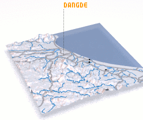 Places with similar names to Ðàng Ðế, Vietnam ::
Disclaimer :: Information on this page comes without warranty of any kind |
||
|
Where is Ðàng Ðế? Elevation and coordinates ::
Latitude (lat): 17°41'0"N Longitude (lon): 106°28'0"E
Elevation (approx.): 23m (map arrows pan, magnifying glasses zoom) |
||
|
Visiting Ðàng Ðế? Hotel/Accommodation ::
Book a hotel in Ðàng Ðế Travel Guide ::
Buy a travel guide for Vietnam rental cars ::
car rental offers GPS waypoint ::
download a GPX waypoint (PoI) of Ðàng Ðế for your GPS receiver
|
||