|
search place name
|
||
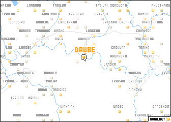
Ðầu Bé (Hà Bắc, Vietnam)Ðầu Bé is a town in the Hà Bắc region of Vietnam. An overview map of the region around Ðầu Bé is displayed below.
regional and 3d topo map of Ðầu Bé, Vietnam ::
Ðầu Bé airports ::
The nearest airport is HAN - Hanoi Noibai Intl, located 90.1 km west of Ðầu Bé.
Other airports nearby include NNG - Nanning Wuxu (210.0 km north east), Nearby towns ::
Ðồng Lới (1.7km west) //
Làng San (1.9km north) //
Ao Tan (2.5km north east) //
Xan Bến (3.7km north) //
Trại Háp (3.7km north) //
Trại Moun (4.1km north east) //
Phong Côt (4.1km north east) //
Déo But (5.2km east) //
Làng Cân (5.8km north) //
Làng Xa (5.5km east) //
Ka La (6.4km north west) //
Phu Nhuân (6.9km east) //
Làng Phi Ðiên (7.4km north) //
Lâm Binh (7.2km east) //
Cao Vuan (7.1km east) //
Ao Loan (7.6km north) //
Kép Hạ (7.6km north west) //
Nam Ðiến (7.8km south west) //
Làng Traum (8.2km north west) //
Trại Giao (9.0km south west) //
Trại San (8.9km south east) //
Trại Lam (8.9km south west) //
Làng Man (9.0km north east) //
Dối Sơn (10.1km south west) //
[all distances 'as the bird flies' and approximate] 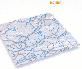 Places with similar names to Ðầu Bé, Vietnam ::
Disclaimer :: Information on this page comes without warranty of any kind |
||
|
Where is Ðầu Bé? Elevation and coordinates ::
Latitude (lat): 21°20'0"N Longitude (lon): 106°40'0"E
Elevation (approx.): 32m (map arrows pan, magnifying glasses zoom) |
||
|
Visiting Ðầu Bé? Hotel/Accommodation ::
Book a hotel in Ðầu Bé Travel Guide ::
Buy a travel guide for Vietnam rental cars ::
car rental offers GPS waypoint ::
download a GPX waypoint (PoI) of Ðầu Bé for your GPS receiver
|
||