|
search place name
|
||
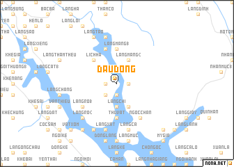
Ðầu Dồng (Vietnam)Ðầu Dồng is a town in Vietnam. An overview map of the region around Ðầu Dồng is displayed below.
regional and 3d topo map of Ðầu Dồng, Vietnam ::
Ðầu Dồng airports ::
The nearest airport is HAN - Hanoi Noibai Intl, located 131.3 km south east of Ðầu Dồng.
Nearby towns ::
Làng Giang (1.7km east) //
Ðông Tung (1.9km south) //
Làng Qui (1.7km west) //
Hương Giang (1.7km west) //
Làng Sầu (2.5km south west) //
Làng Chùa (3.7km south) //
Làng Chỉ (3.7km south) //
Làng Mang (2) (4.1km north east) //
Làng Bạc (4.1km south east) //
Lịch Hạ (5.1km north west) //
Nhà Lừa (5.6km south) //
Thu Vật (5.6km south) //
Làng Mang (1) (5.6km north) //
Làng Mác (5.8km north) //
Ngọc Chấn (6.5km south east) //
Làng Ro (1) (6.3km south west) //
Làng Mường (7.6km north) //
Làng Cá (7.6km south) //
Làng Xát (7.6km south) //
Làng Ro (2) (7.6km south west) //
Làng Táo (8.2km north west) //
Bản Ðụng Xá (8.2km south west) //
Làng Riếng (8.2km south west) //
Làng Ðồng Bát (9.0km south west) //
Bản Lôi Quông (9.0km south west) //
Làng Giồng (2) (10.1km south east) //
Lũng Hà (10.1km south west) //
Vật Xóm (10.1km south west) //
[all distances 'as the bird flies' and approximate] 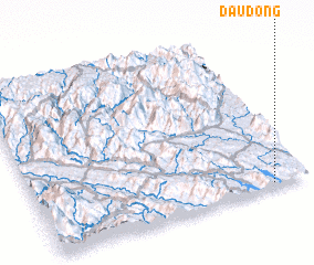 Places with similar names to Ðầu Dồng, Vietnam ::
Disclaimer :: Information on this page comes without warranty of any kind |
||
|
Where is Ðầu Dồng? Elevation and coordinates ::
Latitude (lat): 22°1'0"N Longitude (lon): 104°52'0"E
Elevation (approx.): 80m (map arrows pan, magnifying glasses zoom) |
||
|
Visiting Ðầu Dồng? Hotel/Accommodation ::
Book a hotel in Ðầu Dồng Travel Guide ::
Buy a travel guide for Vietnam rental cars ::
car rental offers GPS waypoint ::
download a GPX waypoint (PoI) of Ðầu Dồng for your GPS receiver
|
||