|
search place name
|
||
De Rohlang (1) (Vietnam)De Rohlang (1) is a town in Vietnam. An overview map of the region around De Rohlang (1) is displayed below.
regional and 3d topo map of De Rohlang (1), Vietnam ::

De Rohlang (1) airports ::
The nearest airport is NHA - Nhatrang, located 214.9 km south of De Rohlang (1).
Other airports nearby include DAD - Danang Intl (220.9 km north), Nearby towns ::
Plé Co Em (2.6km south east) //
De Ponang (2.6km south east) //
De Lok So (2.6km south west) //
De Pouang (4.0km north east) //
Kon Djong (5.2km north east) //
De Rohlang (2) (5.4km west) //
Cửu Ðao (5.8km south) //
De Homau (5.8km north) //
Tân Lập (5.8km south) //
De Lok Tro (5.8km south) //
Kannack (2) (5.7km west) //
Plei Ta Moc (3) (6.5km south west) //
Kon Ron (7.4km east) //
Plei Kon Gô (1) (7.7km south west) //
Kannack (1) (7.7km north west) //
An Thạch (2) (7.7km south east) //
An Bình (1) (8.2km south east) //
Kon Creh (8.2km north west) //
Plei Xu Lon (9.2km south west) //
De Dang (1) (9.1km north west) //
An Bình (2) (9.2km south east) //
Kon Cat (9.2km north east) //
An Diên Bắc (10.3km south east) //
[all distances 'as the bird flies' and approximate] 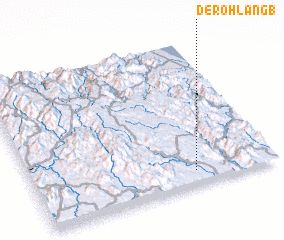 Places with similar names to De Rohlang (1), Vietnam :: Disclaimer :: Information on this page comes without warranty of any kind |
||
|
Where is De Rohlang (1)? Elevation and coordinates ::
Latitude (lat): 14°6'0"N Longitude (lon): 108°40'0"E
Elevation (approx.): 473m (map arrows pan, magnifying glasses zoom) |
||
|
Visiting De Rohlang (1)? Hotel/Accommodation ::
Book a hotel in De Rohlang (1) Travel Guide ::
Buy a travel guide for Vietnam rental cars ::
car rental offers GPS waypoint ::
download a GPX waypoint (PoI) of De Rohlang (1) for your GPS receiver
|
||