|
search place name
|
||
Ðồng Ao (Vietnam)Ðồng Ao is a town in Vietnam. An overview map of the region around Ðồng Ao is displayed below.
regional and 3d topo map of Ðồng Ao, Vietnam ::

Ðồng Ao airports ::
The nearest airport is HAN - Hanoi Noibai Intl, located 82.3 km north of Ðồng Ao.
Nearby towns ::
Chung Thứ (1.9km south) //
Kẻ So (1.9km north) //
Võ Giang (1.7km west) //
Thử Hòa (2.5km south west) //
Dương Xá (2.5km north east) //
Thânh Liêm (3.5km east) //
Nham Kênh (3.7km south) //
Thịnh Châu (3.7km north) //
Kỷ Cẩu (3.9km south east) //
Hòa Ngải (3.9km north east) //
Yên Phú (4.1km south east) //
Mạo Chử (4.1km north east) //
Bằng Khê (5.1km north east) //
Trượng Trâu (5.8km north) //
Lạt Sơn (5.8km north) //
Phủ Lý (6.6km north) //
Thông Thôn (6.6km south east) //
Mỹ Xá (6.4km south east) //
Châu Cầu (7.4km north) //
Núi Do (6.9km east) //
Ðại Bái (7.6km south) //
Sơn Nga (7.2km east) //
Liễu Ðội (7.2km east) //
Ðai Ðong (7.9km south west) //
Bản Phát Trại (8.2km north west) //
Bút Phong (8.2km north west) //
Nhất Giáp (7.9km north east) //
Tri Chuật (10.2km south east) //
Tử Mãc (10.2km south east) //
[all distances 'as the bird flies' and approximate] 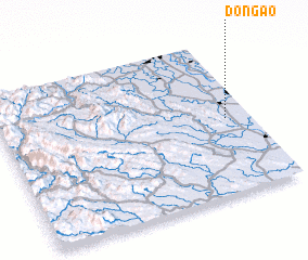 Places with similar names to Ðồng Ao, Vietnam ::
Disclaimer :: Information on this page comes without warranty of any kind |
||
|
Where is Ðồng Ao? Elevation and coordinates ::
Latitude (lat): 20°29'0"N Longitude (lon): 105°54'0"E
Elevation (approx.): 3m (map arrows pan, magnifying glasses zoom) |
||
|
Visiting Ðồng Ao? Hotel/Accommodation ::
Book a hotel in Ðồng Ao Travel Guide ::
Buy a travel guide for Vietnam rental cars ::
car rental offers GPS waypoint ::
download a GPX waypoint (PoI) of Ðồng Ao for your GPS receiver
|
||