|
search place name
|
||
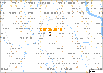
Ðông Dương (Vietnam)Ðông Dương is a town in Vietnam. An overview map of the region around Ðông Dương is displayed below.
regional and 3d topo map of Ðông Dương, Vietnam ::
Ðông Dương airports ::
The nearest airport is HAN - Hanoi Noibai Intl, located 55.9 km north of Ðông Dương.
Nearby towns ::
Quáng Tái Thượng (1.7km east) //
Ứng Hòa Phủ (2.5km north west) //
Quất Lâm (2.5km south east) //
Thái Bình (3.5km west) //
Mỹ Ðức (3.5km west) //
Thanh Hội (3.5km east) //
Khánh Vân (3.5km east) //
Xóm Ngoài (3.7km south) //
Vân Ðình (3.9km north west) //
Dũng Cảm (3.9km north east) //
Nội Xá (3.9km south west) //
Hoàng Lưu (4.1km north east) //
Vũ Nội (5.1km north west) //
Kim Lũng (5.1km north east) //
Nam Dương (5.1km south west) //
Trầm Lộng (5.1km south east) //
Dúc Tho (5.2km west) //
Bao Thon (5.6km north) //
Doàn Xá (5.5km west) //
Phù Lưu Tế (5.5km west) //
Tế Tiên (5.5km west) //
Thanh Sam (6.6km north west) //
Họa Ðông (6.4km north west) //
Hà Xá (6.6km south west) //
Vien Hoàng (6.6km north east) //
Xuân Bay (6.6km south east) //
Ngọ Xá (6.4km south west) //
Ha Thôn (7.4km north) //
Bối Khê (6.9km east) //
[all distances 'as the bird flies' and approximate]  Places with similar names to Ðông Dương, Vietnam ::
// Daungdong (PH)
// Tangtong (MM)
// Tangtong (MM)
// Tangtung (MM)
// Taungdaung (MM)
// Tankotenga (BF)
// Tongotongo (CD)
// Dingdinga (IN)
// Tangatanga (ID)
// Dong Dang (MY)
Disclaimer :: Information on this page comes without warranty of any kind |
||
|
Where is Ðông Dương? Elevation and coordinates ::
Latitude (lat): 20°43'0"N Longitude (lon): 105°48'0"E
Elevation (approx.): 7m (map arrows pan, magnifying glasses zoom) |
||
|
Visiting Ðông Dương? Hotel/Accommodation ::
Book a hotel in Ðông Dương Travel Guide ::
Buy a travel guide for Vietnam rental cars ::
car rental offers GPS waypoint ::
download a GPX waypoint (PoI) of Ðông Dương for your GPS receiver
|
||