|
search place name
|
||
Ðông Dư Thượng (Vietnam)Ðông Dư Thượng is a town in Vietnam. An overview map of the region around Ðông Dư Thượng is displayed below.
regional and 3d topo map of Ðông Dư Thượng, Vietnam ::

Ðông Dư Thượng airports ::
The nearest airport is HAN - Hanoi Noibai Intl, located 27.8 km north west of Ðông Dư Thượng.
Nearby towns ::
Thổ Khối (1.7km west) //
Cam Thon (1.9km north) //
Thuận Tốn (1.9km south) //
Thạch Cầu (1.9km north) //
Ngô Thôn (2.5km north west) //
Bát Trang (2.5km south west) //
Ða Tốn (2.5km south east) //
Ðông Dư Hạ (3.5km west) //
Kim Quan (4.1km south west) //
Xuân Quan (4.1km south west) //
Cư Ðồng (4.1km north west) //
Cư Linh (4.1km north west) //
Ðặng Xá (4.1km north east) //
Kiêu Kỵ (3.9km south east) //
Phú Th (3.9km north east) //
Mai Phúc (5.1km north west) //
Thúy Lĩnh (5.1km south west) //
Tram Thon (5.1km north west) //
Cư Ða (5.1km north east) //
Cửu Cảo (5.1km south east) //
Vĩnh Tuy (5.2km west) //
Vụ Dồng (5.6km north) //
Quan Tình (5.8km north) //
Như Quỳnh (5.5km east) //
Ðông Phu (5.5km west) //
Lâm Du (5.5km west) //
Nam Dư Thượng (5.5km west) //
Khuyến Lương (6.4km south west) //
Trai Tuc (6.4km south east) //
[all distances 'as the bird flies' and approximate] 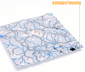 Places with similar names to Ðông Dư Thượng, Vietnam :: Disclaimer :: Information on this page comes without warranty of any kind |
||
|
Where is Ðông Dư Thượng? Elevation and coordinates ::
Latitude (lat): 21°0'0"N Longitude (lon): 105°56'0"E
Elevation (approx.): 7m (map arrows pan, magnifying glasses zoom) |
||
|
Visiting Ðông Dư Thượng? Hotel/Accommodation ::
Book a hotel in Ðông Dư Thượng Travel Guide ::
Buy a travel guide for Vietnam rental cars ::
car rental offers GPS waypoint ::
download a GPX waypoint (PoI) of Ðông Dư Thượng for your GPS receiver
|
||