|
search place name
|
||
Ðông Giao (Hà Bắc, Vietnam)Ðông Giao is a town in the Hà Bắc region of Vietnam. An overview map of the region around Ðông Giao is displayed below.
regional and 3d topo map of Ðông Giao, Vietnam ::

Ðông Giao airports ::
The nearest airport is HAN - Hanoi Noibai Intl, located 77.9 km west of Ðông Giao.
Other airports nearby include NNG - Nanning Wuxu (215.7 km north east), Nearby towns ::
Trại Cốn (2.5km north west) //
Binh Nội (2.5km south east) //
Kiên Lao (3.7km north) //
Ðồng Gianh (4.1km south west) //
Làng Khả Cửu (5.1km north west) //
Chũ (5.1km south east) //
Làng Mau (5.1km north east) //
Trại Hạ (5.6km north) //
Ðinh Chê (5.2km east) //
Lầm (5.8km south) //
Làng Ba (5.8km south) //
Trại Bông (5.5km east) //
Phi Lễ (6.4km south west) //
Vực Bùn (6.4km south east) //
Cao Dean (6.4km north east) //
Bền Huyên (6.5km south east) //
Ðất Ðỏ (7.6km south) //
Mỹ Nương (7.6km south) //
Bá Mối (7.6km south) //
Chợ Hạ (7.1km east) //
Giáp Trung (7.1km east) //
Yên Phú (8.2km south west) //
Thach Luong (8.2km north west) //
[all distances 'as the bird flies' and approximate] 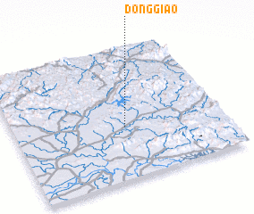 Places with similar names to Ðông Giao, Vietnam ::
Disclaimer :: Information on this page comes without warranty of any kind |
||
|
Where is Ðông Giao? Elevation and coordinates ::
Latitude (lat): 21°24'0"N Longitude (lon): 106°32'0"E
Elevation (approx.): 26m (map arrows pan, magnifying glasses zoom) |
||
|
Visiting Ðông Giao? Hotel/Accommodation ::
Book a hotel in Ðông Giao Travel Guide ::
Buy a travel guide for Vietnam rental cars ::
car rental offers GPS waypoint ::
download a GPX waypoint (PoI) of Ðông Giao for your GPS receiver
|
||