|
search place name
|
||
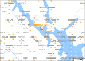
Ðông Lang (Vietnam)Ðông Lang is a town in Vietnam. An overview map of the region around Ðông Lang is displayed below.
regional and 3d topo map of Ðông Lang, Vietnam ::
Ðông Lang airports ::
The nearest airport is HAN - Hanoi Noibai Intl, located 126.7 km south east of Ðông Lang.
Nearby towns ::
Làng Giồng (1) (0.0km north) //
Làng Xát (1.9km north) //
Làng Gênh (1.7km east) //
Làng Ke (2.5km south east) //
Bản Ðụng Xá (2.5km north west) //
Làng Riếng (2.5km north west) //
Làng Muc (3.4km east) //
Bản Lôi Quông (3.9km north west) //
Làng Ðồng Bát (3.9km north west) //
Cam An (4.1km south east) //
Làng Cá (3.9km north east) //
Nhà Lừa (4.1km north east) //
Thu Vật (4.1km north east) //
Làng Bang (5.1km south west) //
Ngòi Mỏi (5.1km south west) //
Làng Chẽ (5.1km south east) //
Làng Ro (2) (5.1km north west) //
Khê Nhàn (5.2km west) //
Lũng Hà (5.5km west) //
Vật Xóm (5.5km west) //
Ngôi Cát (5.8km south) //
Làng Chỉ (5.8km north) //
Làng Chùa (5.8km north) //
Làng Ro (1) (6.5km north west) //
Làng Bạc (6.5km north east) //
Ngọc Chấn (6.4km north east) //
Phù Khang (7.4km south) //
Ngòi Kè (6.9km west) //
Làng Sầu (7.4km north) //
[all distances 'as the bird flies' and approximate] 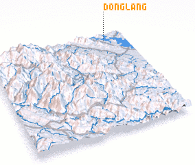 Places with similar names to Ðông Lang, Vietnam ::
// Teng Leng (MM)
// Dengling (DE)
// Tengling (DE)
// Dong Luang (TH)
// Tanglongo (BF)
// Tankoulounga (BF)
// Dang-Lang (CF)
// Tangalanga (NG)
// Tong Long (LA)
// Tenggelanga (ID)
Disclaimer :: Information on this page comes without warranty of any kind |
||
|
Where is Ðông Lang? Elevation and coordinates ::
Latitude (lat): 21°56'0"N Longitude (lon): 104°51'0"E
Elevation (approx.): 53m (map arrows pan, magnifying glasses zoom) |
||
|
Visiting Ðông Lang? Hotel/Accommodation ::
Book a hotel in Ðông Lang Travel Guide ::
Buy a travel guide for Vietnam rental cars ::
car rental offers GPS waypoint ::
download a GPX waypoint (PoI) of Ðông Lang for your GPS receiver
|
||