|
search place name
|
||
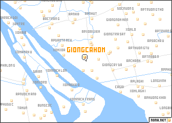
Giồng Cà Hom (Trà Vinh, Vietnam)Giồng Cà Hom is a town in the Trà Vinh region of Vietnam. An overview map of the region around Giồng Cà Hom is displayed below.
regional and 3d topo map of Giồng Cà Hom, Vietnam ::
Giồng Cà Hom airports ::
The nearest airport is SGN - Ho Chi Minh City Tansonnhat Intl, located 136.3 km north of Giồng Cà Hom.
Other airports nearby include PNH - Phnom-penh Phnom Penh Intl (260.4 km north west), Nearby towns ::
Giồng Nhum (2.0km south) //
Ấp Giữa (2.0km north) //
Giồng Ðinh (2.3km south east) //
Giồng Dàm Rai (2.7km east) //
Ấp Chợ (3.8km north) //
Trà Cú (4.2km north) //
Ấp Cá Lóc (4.3km south east) //
Xóm Xoài Rùm (5.0km west) //
Giồng Hàm Giang (5.2km east) //
Ấp Xoài Xiêm (5.6km north) //
Giồng Cả Lé (5.6km east) //
Giồng Cây Ða (6.0km east) //
Ấp Ðàm Trà Cứ (6.2km north west) //
Xóm Bà Keo (6.9km south west) //
Xóm Rạch Lớn (7.0km south west) //
Giồng Tay Gro (7.5km north east) //
Giồng Trà Sầt (8.0km north east) //
Ấp Lưu Cừ (8.2km north west) //
Ấp Ba (8.9km north) //
Giồng Thốt Lốt (8.8km east) //
Cả Gối (10.0km south east) //
Giồng Nom Men (10.6km north east) //
Ấp Quang Giá (1) (10.8km north west) //
Bắc Trang (11.0km north west) //
[all distances 'as the bird flies' and approximate] 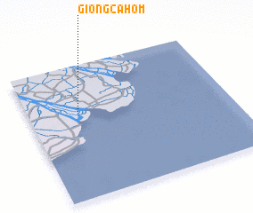 Places with similar names to Giồng Cà Hom, Vietnam :: Disclaimer :: Information on this page comes without warranty of any kind |
||
|
Where is Giồng Cà Hom? Elevation and coordinates ::
Latitude (lat): 9°39'3"N Longitude (lon): 106°15'19"E
Elevation (approx.): 1m (map arrows pan, magnifying glasses zoom) |
||
|
Visiting Giồng Cà Hom? Hotel/Accommodation ::
Book a hotel in Giồng Cà Hom Travel Guide ::
Buy a travel guide for Vietnam rental cars ::
car rental offers GPS waypoint ::
download a GPX waypoint (PoI) of Giồng Cà Hom for your GPS receiver
|
||