|
search place name
|
||
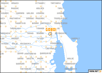
Gò Bồi (Vietnam)Gò Bồi is a town in Vietnam. An overview map of the region around Gò Bồi is displayed below.
regional and 3d topo map of Gò Bồi, Vietnam ::
Gò Bồi airports ::
The nearest airport is NHA - Nhatrang, located 185.1 km south of Gò Bồi.
Nearby towns ::
Kim Ðông (0.0km north) //
Phố Ðồng (2) (1.9km north) //
Dương Thiện (1) (1.9km south) //
Tùng Giảng (1.8km west) //
An Lợi (4) (2.6km north east) //
Phú Hậu (1) (2.6km north east) //
Xuân Phương (1) (2.6km south west) //
Huỳnh Giãng (3.6km east) //
Lộc Thượng (3.7km south) //
An Hòa (3) (3.6km west) //
Vinh Quang (4.1km south east) //
Vân Triêm (1) (4.1km north west) //
Mỹ Trung (4.1km south west) //
Phụng Sơn (4.1km south west) //
Thanh Quang (4.0km north west) //
Tịnh Hòa (4.0km north west) //
Tú Thủy (4.0km south west) //
Phú Hậu (3) (5.2km north east) //
Trung Lương (1) (5.2km north east) //
Khe Ðá Sứ (5.2km south east) //
Phương Thái (5.6km north) //
Lộc Trung (5.6km south) //
Lộc Hạ (1) (5.6km south) //
Phương Phi (5.8km north) //
Quảng Ðiền (5.7km west) //
Tuấn Lễ (1) (5.7km west) //
Trung Lương (2) (6.6km north east) //
Dịnh Thuận (6.5km north west) //
Bình An (6.5km north west) //
[all distances 'as the bird flies' and approximate]  Places with similar names to Gò Bồi, Vietnam ::
Disclaimer :: Information on this page comes without warranty of any kind |
||
|
Where is Gò Bồi? Elevation and coordinates ::
Latitude (lat): 13°54'0"N Longitude (lon): 109°13'0"E
Elevation (approx.): 1m (map arrows pan, magnifying glasses zoom) |
||
|
Visiting Gò Bồi? Hotel/Accommodation ::
Book a hotel in Gò Bồi Travel Guide ::
Buy a travel guide for Vietnam rental cars ::
car rental offers GPS waypoint ::
download a GPX waypoint (PoI) of Gò Bồi for your GPS receiver
|
||