|
search place name
|
||
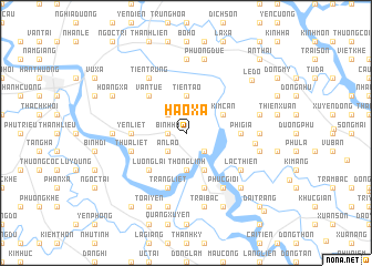
Hào Xá (Hải Hưng, Vietnam)Hào Xá is a town in the Hải Hưng region of Vietnam. An overview map of the region around Hào Xá is displayed below.
regional and 3d topo map of Hào Xá, Vietnam ::
Hào Xá airports ::
The nearest airport is HAN - Hanoi Noibai Intl, located 75.7 km north west of Hào Xá.
Other airports nearby include NNG - Nanning Wuxu (259.8 km north east), Nearby towns ::
Bình Hà (1.7km west) //
An Lão (2.5km south west) //
Xuán Dám (2.5km south east) //
Du La (2.5km north west) //
Thống Lĩnh (3.7km south) //
Tiên Tảo (3.7km north) //
Kim Can (3.9km north east) //
Lại Xá (4.1km south east) //
Lương Lại (5.1km south west) //
Vạn Tuế (5.1km north west) //
Yen Liet (5.2km west) //
Phì Già (5.2km east) //
Làng Ðộng (5.2km west) //
Thừa Liệt (5.5km west) //
Phượng Ðầu (5.8km south) //
Tráng Liệt (5.8km south) //
Bá Hoàng (5.8km south) //
Phúc Gioi (6.6km south east) //
Lạc Thiện (6.4km south east) //
Tiên Trung (6.5km north west) //
Cổ Chẩm (6.5km north west) //
Ðông Gia (6.6km east) //
Cẩm La (6.9km east) //
Khè Phương (6.9km east) //
Câp Thượng (6.9km west) //
Cổ Dũng (7.4km north) //
Phạm Xá (7.4km north) //
Hoàng Xá (7.2km east) //
Hải Ninh (7.2km east) //
[all distances 'as the bird flies' and approximate]  Places with similar names to Hào Xá, Vietnam ::
Disclaimer :: Information on this page comes without warranty of any kind |
||
|
Where is Hào Xá? Elevation and coordinates ::
Latitude (lat): 20°54'0"N Longitude (lon): 106°27'0"E
Elevation (approx.): 3m (map arrows pan, magnifying glasses zoom) |
||
|
Visiting Hào Xá? Hotel/Accommodation ::
Book a hotel in Hào Xá Travel Guide ::
Buy a travel guide for Vietnam rental cars ::
car rental offers GPS waypoint ::
download a GPX waypoint (PoI) of Hào Xá for your GPS receiver
|
||