|
search place name
|
||
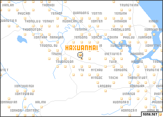
Hạ Xuân Mai (Vietnam)Hạ Xuân Mai is a town in Vietnam. An overview map of the region around Hạ Xuân Mai is displayed below.
regional and 3d topo map of Hạ Xuân Mai, Vietnam ::
Hạ Xuân Mai airports ::
The nearest airport is SNO - Sakon Nakhon, located 219.8 km south west of Hạ Xuân Mai.
Other airports nearby include ZVK - Savannakhet (230.4 km south west), Nearby towns ::
Ðồng Lạc (0.0km north) //
Ban Trung (1.8km east) //
Ðông Bàn (1.8km east) //
Tiền Lôi (1.8km east) //
Bao Loc (1.9km south) //
Ðô Hành (1.9km south) //
Thượng Lôi (1.9km north) //
Xóm Mới (1.9km north) //
Phương Mỹ (2.6km south east) //
Cương Xa (2.6km south east) //
Húng Long (2.6km south east) //
Trai Lê (2.6km north east) //
Bàn Thạch (2.6km north east) //
Bảo Tháp (2.6km south west) //
Y Tu (3.7km south) //
Trai Xoi (3.7km south) //
Yên Ðồng (3.7km north) //
Ðiền Xá (3.5km west) //
Tiền Lai (4.1km south east) //
Nghiên Hùng (4.1km north east) //
Vĩnh Phong (4.1km north east) //
Xóm Gia (4.0km north east) //
Chí Lưu (4.0km north east) //
Ða Bên (4.0km north east) //
Hoàng Hà (4.1km south west) //
Trại Tiêu (4.1km south west) //
Quần Ngọc (4.1km north west) //
Trường Sơn (4.0km south west) //
My Châu (5.1km south east) //
[all distances 'as the bird flies' and approximate] 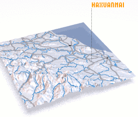 Places with similar names to Hạ Xuân Mai, Vietnam :: Disclaimer :: Information on this page comes without warranty of any kind |
||
|
Where is Hạ Xuân Mai? Elevation and coordinates ::
Latitude (lat): 18°24'0"N Longitude (lon): 105°46'0"E
Elevation (approx.): 26m (map arrows pan, magnifying glasses zoom) |
||
|
Visiting Hạ Xuân Mai? Hotel/Accommodation ::
Book a hotel in Hạ Xuân Mai Travel Guide ::
Buy a travel guide for Vietnam rental cars ::
car rental offers GPS waypoint ::
download a GPX waypoint (PoI) of Hạ Xuân Mai for your GPS receiver
|
||