|
search place name
|
||
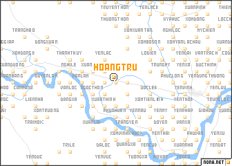
Hoàng Trù (Vietnam)Hoàng Trù is a town in Vietnam. An overview map of the region around Hoàng Trù is displayed below.
regional and 3d topo map of Hoàng Trù, Vietnam ::
Hoàng Trù airports ::
The nearest airport is SNO - Sakon Nakhon, located 225.1 km south west of Hoàng Trù.
Nearby towns ::
Khoa Cử (0.0km north) //
Hữu Biêt (1.8km east) //
Làng Bui (1.8km east) //
Kim Liêu (1.8km west) //
Gia Lạc (1.8km west) //
Ðôn Nhượng (2.6km south east) //
Lang Ðông (2.6km south east) //
Vân Hôi (2.6km south east) //
Bố Ần (2.6km south west) //
Làng Ða Lac (2.6km north west) //
Tinh Lý (3.7km south) //
Bố Ðức (3.5km west) //
Yen Quả (3.5km west) //
Khang Thọ (4.1km south east) //
Xuân Thinh (4.1km south west) //
Ðông Lám (4.1km south west) //
Ngọc Thôn (4.0km south west) //
Cửu Yên (4.0km south west) //
Yên Lạc (4.1km north west) //
Thanh Dàm (4.0km north west) //
Xuân Lieu (4.0km north west) //
Ðông Thịnh (5.1km south west) //
Nhan Tháp (5.1km south west) //
Văn Lâm (5.3km west) //
Phú Nhuận (5.6km south) //
Liêu Xuyên (5.6km south) //
Uoc Le (1) (5.6km east) //
Ngọc Diên (5.6km east) //
Dóng Nhân (5.6km west) //
[all distances 'as the bird flies' and approximate]  Places with similar names to Hoàng Trù, Vietnam ::
Disclaimer :: Information on this page comes without warranty of any kind |
||
|
Where is Hoàng Trù? Elevation and coordinates ::
Latitude (lat): 18°41'0"N Longitude (lon): 105°34'0"E
Elevation (approx.): 10m (map arrows pan, magnifying glasses zoom) |
||
|
Visiting Hoàng Trù? Hotel/Accommodation ::
Book a hotel in Hoàng Trù Travel Guide ::
Buy a travel guide for Vietnam rental cars ::
car rental offers GPS waypoint ::
download a GPX waypoint (PoI) of Hoàng Trù for your GPS receiver
|
||