|
search place name
|
||
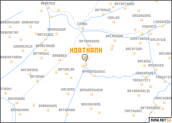
Hòa Thành (Cà Ma, Vietnam)Hòa Thành is a town in the Cà Ma region of Vietnam. An overview map of the region around Hòa Thành is displayed below.
regional and 3d topo map of Hòa Thành, Vietnam ::
Hòa Thành airports ::
The nearest airport is SGN - Ho Chi Minh City Tansonnhat Intl, located 250.0 km north east of Hòa Thành.
Nearby towns ::
Dinh Ðiền Cống Ðá (0.6km south) //
Ấp Sông Cái (0.8km north east) //
Ấp Hóa Tách (1.2km south west) //
Ấp Mương Ðiều (2) (3.5km south east) //
Ấp Thạnh Ðiền (3.6km north west) //
Ấp Tân Phong (3.6km north) //
Ấp Kinh Xáng (4.8km south west) //
Ấp Tân Lập (5.0km south west) //
Ấp Ba Bèo (5.7km west) //
Ấp Bùng Binh (6.1km north east) //
Ấp Ba Vinh (6.6km north east) //
Ấp Nha Phấn (6.9km west) //
Ấp Mương Ðiều (1) (7.2km south) //
Cà Mau (7.3km north) //
Ấp Cái Ngan (7.7km north east) //
Ấp Cái Rô (8.0km south west) //
Ấp Ông Muộn (8.8km north west) //
Ấp Rạch Muối (9.1km west) //
Ấp Cỏ Xước (10.0km north west) //
Xóm Lơn (10.4km north east) //
[all distances 'as the bird flies' and approximate] 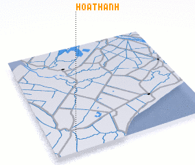 Places with similar names to Hòa Thành, Vietnam ::
Disclaimer :: Information on this page comes without warranty of any kind |
||
|
Where is Hòa Thành? Elevation and coordinates ::
Latitude (lat): 9°6'42"N Longitude (lon): 105°9'28"E
Elevation (approx.): 5m (map arrows pan, magnifying glasses zoom) |
||
|
Visiting Hòa Thành? Hotel/Accommodation ::
Book a hotel in Hòa Thành Travel Guide ::
Buy a travel guide for Vietnam rental cars ::
car rental offers GPS waypoint ::
download a GPX waypoint (PoI) of Hòa Thành for your GPS receiver
|
||