|
search place name
|
||
Hương Thiêu Yên (Thanh Hóa, Vietnam)Hương Thiêu Yên is a town in the Thanh Hóa region of Vietnam. An overview map of the region around Hương Thiêu Yên is displayed below.
regional and 3d topo map of Hương Thiêu Yên, Vietnam ::

Hương Thiêu Yên airports ::
The nearest airport is HAN - Hanoi Noibai Intl, located 134.9 km north of Hương Thiêu Yên.
Nearby towns ::
Ðô Thôn (1.7km north west) //
Ðan Nê Thương (1.7km north west) //
Dắc Lộc (2.1km north west) //
Yên Dương (2.6km west) //
Hồ Nam (2.7km east) //
Mỹ Ðúc (3.0km north west) //
Van Bân (3.4km north) //
Chau Thon (4.2km south) //
Làng Trinh (4.2km south) //
Vĩnh Lộc (4.3km north east) //
Phúc Tường (4.4km east) //
Làng Mương (4.5km west) //
Nhật Quang (4.7km east) //
Khoái Lạc (4.8km south west) //
Phú Sơn (5.3km north) //
Mỹ Diềm (5.4km north west) //
Ca Ðiệp (5.5km north east) //
Phù Quâng (5.5km north east) //
Ðôn Trang (5.8km north west) //
Phuc Tỉnh (5.9km south west) //
Da Nam (6.0km west) //
Bùi Thượng (6.0km west) //
Phú Tinh (6.5km south west) //
Ðồng Nhân (6.5km south west) //
Phong Hậu (6.5km south west) //
Phác Thôn (6.5km south east) //
Mỹ Quan (6.2km west) //
Pha Ngữ (6.3km east) //
Lạc Ngọc (6.4km west) //
[all distances 'as the bird flies' and approximate] 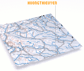 Places with similar names to Hương Thiêu Yên, Vietnam :: Disclaimer :: Information on this page comes without warranty of any kind |
||
|
Where is Hương Thiêu Yên? Elevation and coordinates ::
Latitude (lat): 20°1'12"N Longitude (lon): 105°35'28"E
Elevation (approx.): 14m (map arrows pan, magnifying glasses zoom) |
||
|
Visiting Hương Thiêu Yên? Hotel/Accommodation ::
Book a hotel in Hương Thiêu Yên Travel Guide ::
Buy a travel guide for Vietnam rental cars ::
car rental offers GPS waypoint ::
download a GPX waypoint (PoI) of Hương Thiêu Yên for your GPS receiver
|
||