|
search place name
|
||
Ké Sổ (Vietnam)Ké Sổ is a town in Vietnam. An overview map of the region around Ké Sổ is displayed below.
regional and 3d topo map of Ké Sổ, Vietnam ::

Nearby towns ::
Kẻ Vình (4.1km south east) //
Ðồng Nang (4.0km north east) //
Kẻ Mon (5.1km north east) //
Làng Nươc Xạnh (5.6km south) //
Kẻ Lám (5.8km south) //
Kẻ Mo (5.8km south) //
Kẻ Trọc (6.6km south east) //
Làng Trùng (6.4km north east) //
Làng Mơ (6.4km south west) //
Kẻ Mo (7.4km north) //
Làng Láo (7.4km north) //
Làng Bã Ngoai (7.0km west) //
Cồn Mit (7.2km east) //
Cồn Lung (7.2km east) //
Làng Trang (7.2km east) //
Làng Xiếm (7.2km east) //
Kẻ Chai (7.6km south) //
Kẻ Mui (7.6km south) //
Kẻ Sồng (7.6km north) //
Làng Bã Trong (7.2km west) //
Làng Mòi (7.6km south east) //
Bản Pâng (7.6km north west) //
Làng Tràng (7.9km north east) //
Làng Bàu (8.2km south east) //
Kẻ Trèo (8.2km north east) //
Trọng Hạp (7.9km north west) //
Bản Cu (7.9km north west) //
Bản Cung (8.2km north west) //
Dồng Giang (8.9km south east) //
[all distances 'as the bird flies' and approximate] 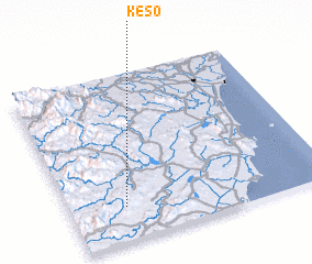 Places with similar names to Ké Sổ, Vietnam ::
Disclaimer :: Information on this page comes without warranty of any kind |
||
|
Where is Ké Sổ? Elevation and coordinates ::
Latitude (lat): 19°12'0"N Longitude (lon): 105°13'0"E
Elevation (approx.): 197m (map arrows pan, magnifying glasses zoom) |
||
|
Visiting Ké Sổ? Hotel/Accommodation ::
Book a hotel in Ké Sổ Travel Guide ::
Buy a travel guide for Vietnam rental cars ::
car rental offers GPS waypoint ::
download a GPX waypoint (PoI) of Ké Sổ for your GPS receiver
|
||