|
search place name
|
||
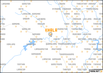
Khả La (Thanh Hóa, Vietnam)Khả La is a town in the Thanh Hóa region of Vietnam. An overview map of the region around Khả La is displayed below.
regional and 3d topo map of Khả La, Vietnam ::
Khả La airports ::
The nearest airport is HAN - Hanoi Noibai Intl, located 175.1 km north of Khả La.
Nearby towns ::
Thượng Bông (1.7km east) //
Bạch Bào (1.9km south) //
Thanh Bối (1.9km north) //
Khả Tín (1.9km north) //
Thiện Na (2.5km south east) //
Khê Th (2.5km south east) //
Ðồng Man (2.5km north west) //
Quang Lang (3.7km south) //
Ngọc Chẫm (4.1km south east) //
Ngư Thôn (4.1km south east) //
Ðồng Ðê (4.1km north west) //
Trường Thọ (4.0km north east) //
Như Xuân (4.0km south west) //
Mậu Lâm (5.1km north west) //
Ðồng Bối (5.2km west) //
Ốc Thôn (5.8km south) //
Phú Thăng (5.8km south) //
Tập Cát (5.6km east) //
Phố Bến Sung (5.6km west) //
Làng Ðồng Sang (5.6km west) //
Trường Quang Tiền (6.4km south east) //
Thổ Vi (6.4km north east) //
Làng Ðồng Thả (6.6km south west) //
Lộc Bòng (6.6km north west) //
Ðồng Ðái (6.6km north west) //
Côn Cương (7.2km east) //
Làng Ðồng Nhơn (7.2km west) //
Ðồng Bèp (7.6km north west) //
Phu Nẫm (7.9km south east) //
[all distances 'as the bird flies' and approximate] 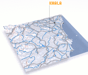 Places with similar names to Khả La, Vietnam ::
Disclaimer :: Information on this page comes without warranty of any kind |
||
|
Where is Khả La? Elevation and coordinates ::
Latitude (lat): 19°39'0"N Longitude (lon): 105°37'0"E
Elevation (approx.): 8m (map arrows pan, magnifying glasses zoom) |
||
|
Visiting Khả La? Hotel/Accommodation ::
Book a hotel in Khả La Travel Guide ::
Buy a travel guide for Vietnam rental cars ::
car rental offers GPS waypoint ::
download a GPX waypoint (PoI) of Khả La for your GPS receiver
|
||