|
search place name
|
||
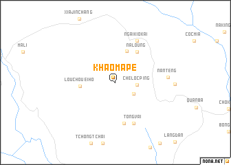
Khào Ma Pé (Hà Giang, Vietnam)Khào Ma Pé is a town in the Hà Giang region of Vietnam. An overview map of the region around Khào Ma Pé is displayed below.
regional and 3d topo map of Khào Ma Pé, Vietnam ::
Khào Ma Pé airports ::
The nearest airport is HAN - Hanoi Noibai Intl, located 230.0 km south east of Khào Ma Pé.
Nearby towns ::
Khao Me (3.3km south east) //
Che Loc Ping (3.2km east) //
Mao Tsao Po (5.4km north) //
Lou Chouei Ho (5.3km west) //
Na Loung (5.9km north east) //
Bản Cheng (6.8km south) //
Tong Vai (7.2km south) //
Làng Me (7.5km north east) //
Ngai Kio Kai (7.5km north east) //
Nan Teng (7.9km east) //
[all distances 'as the bird flies' and approximate] 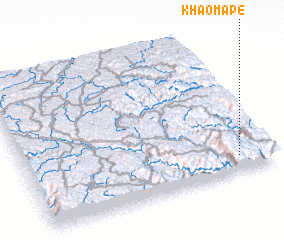 Places with similar names to Khào Ma Pé, Vietnam ::
Disclaimer :: Information on this page comes without warranty of any kind |
||
|
Where is Khào Ma Pé? Elevation and coordinates ::
Latitude (lat): 23°6'20"N Longitude (lon): 104°52'7"E
Elevation (approx.): 1247m (map arrows pan, magnifying glasses zoom) |
||
|
Visiting Khào Ma Pé? Hotel/Accommodation ::
Book a hotel in Khào Ma Pé Travel Guide ::
Buy a travel guide for Vietnam rental cars ::
car rental offers GPS waypoint ::
download a GPX waypoint (PoI) of Khào Ma Pé for your GPS receiver
|
||