|
search place name
|
||
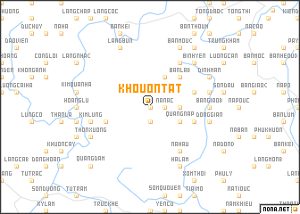
Khouon Tat (Bắc Thái, Vietnam)Khouon Tat is a town in the Bắc Thái region of Vietnam. An overview map of the region around Khouon Tat is displayed below.
regional and 3d topo map of Khouon Tat, Vietnam ::
Khouon Tat airports ::
The nearest airport is HAN - Hanoi Noibai Intl, located 70.8 km south east of Khouon Tat.
Nearby towns ::
Lục Rã (0.0km north) //
Na Nac (1.7km east) //
Bản Khôn Lang (1.9km south) //
Bản Khau Ðúa (3.4km east) //
Bản Bac (4.1km north east) //
Quảng Nạp (3.9km south east) //
Bản La (1) (5.1km north east) //
Bản Chang (5.5km east) //
Bản La (5.5km east) //
Khôi Cháo (5.5km west) //
Quang Ha (5.5km east) //
Na Hau (6.5km south east) //
Bản Pieng (6.5km north east) //
Bản Giao (1) (6.9km east) //
Son Dao (7.1km east) //
Dóng Gian (7.1km east) //
Kim Lung (7.1km west) //
Bình Yên (7.6km north east) //
Ðinh Mán (7.8km north east) //
Hạ Lãm (8.2km south east) //
Bản Mou (2) (8.2km north east) //
Thôn Xương (7.8km south west) //
Làng Bún (8.2km north west) //
Bản Cải (9.0km north east) //
Quảng Ðàm (10.1km south west) //
[all distances 'as the bird flies' and approximate] 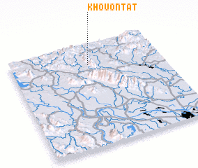 Places with similar names to Khouon Tat, Vietnam ::
Disclaimer :: Information on this page comes without warranty of any kind |
||
|
Where is Khouon Tat? Elevation and coordinates ::
Latitude (lat): 21°48'0"N Longitude (lon): 105°31'0"E
Elevation (approx.): 363m (map arrows pan, magnifying glasses zoom) |
||
|
Visiting Khouon Tat? Hotel/Accommodation ::
Book a hotel in Khouon Tat Travel Guide ::
Buy a travel guide for Vietnam rental cars ::
car rental offers GPS waypoint ::
download a GPX waypoint (PoI) of Khouon Tat for your GPS receiver
|
||