|
search place name
|
||
Kim Phat (Ðắc Lắk, Vietnam)Kim Phat is a town in the Ðắc Lắk region of Vietnam. An overview map of the region around Kim Phat is displayed below.
regional and 3d topo map of Kim Phat, Vietnam ::

Kim Phat airports ::
The nearest airport is NHA - Nhatrang, located 114.8 km east of Kim Phat.
Other airports nearby include SGN - Ho Chi Minh City Tansonnhat Intl (252.7 km south west), Nearby towns ::
Giang Sơn Khu (1) (1.9km south) //
Buôn Pung (1.8km east) //
Giang Sơn Khu (3) (2.6km south east) //
Buôn Ea Khit (2.6km north east) //
Buôn Cuah (5.2km south east) //
Cmơ Rang Prơ (5.6km north) //
Buôn Ea M'tă (5.8km north) //
Buôn Krang (5.8km south) //
Buôn Ea Hning (5.7km west) //
Buôn Yang Reh (6.6km south east) //
Buôn Kô Emông (3) (6.6km north east) //
Buôn Kô Emông (2) (6.6km north east) //
Buôn Chur Dang (7.4km south) //
Buôn Chiêt (7.8km north west) //
Buôn Kô Emông (1) (7.8km north east) //
Buôn Chuê (7.8km south west) //
Buôn Ea Kteh (8.2km south east) //
Buôn Kmăn (9.2km south west) //
[all distances 'as the bird flies' and approximate] 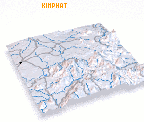 Places with similar names to Kim Phat, Vietnam ::
// Camp Hayt (PH)
// Ga-Mafate (ZA)
// Ga-Maphoto (ZA)
// Ga-Maphoto (ZA)
// Gamba-Fioti (CD)
// Kimvidi (CD)
// Kimfoutou (CG)
// Kāmvādi (IN)
// Kamphata (ZM)
// Cam Fat (VN)
Disclaimer :: Information on this page comes without warranty of any kind |
||
|
Where is Kim Phat? Elevation and coordinates ::
Latitude (lat): 12°32'0"N Longitude (lon): 108°11'0"E
Elevation (approx.): 473m (map arrows pan, magnifying glasses zoom) |
||
|
Visiting Kim Phat? Hotel/Accommodation ::
Book a hotel in Kim Phat Travel Guide ::
Buy a travel guide for Vietnam rental cars ::
car rental offers GPS waypoint ::
download a GPX waypoint (PoI) of Kim Phat for your GPS receiver
|
||