|
search place name
|
||
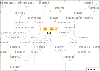
Kon Kơpat (Vietnam)Kon Kơpat is a town in Vietnam. An overview map of the region around Kon Kơpat is displayed below.
regional and 3d topo map of Kon Kơpat, Vietnam ::
Kon Kơpat airports ::
The nearest airport is DAD - Danang Intl, located 186.3 km north of Kon Kơpat.
Nearby towns ::
Kon Jơdreh (1) (0.0km north) //
Kong Cut (1.9km north) //
Kon Drei (1.9km south) //
Kon Mơnay Kơtu (1.8km west) //
Kon Tum Kơ Nâm (2.6km south west) //
Kon Cho Dri (3.7km south) //
Kon Tum Kơ Pang (4.0km south west) //
Xã Do Lai (5.2km north west) //
Plei Kon Hara (5.2km south west) //
Kon Tơneh (5.4km east) //
Kon Rơnang (5.7km east) //
Kon Tum (5.7km west) //
Kong Zré (5.8km north) //
Plei Krako (6.6km south west) //
Kon Kơlang (1) (6.5km north east) //
Kon Kơtu (6.6km south east) //
Plei Groi (6.5km south west) //
Kon Tum (2) (7.4km west) //
Kon Sơm Luh (7.4km east) //
Plei Trum (7.4km west) //
Xã Phường Quy (1) (7.4km west) //
Kon Rơbang (7.4km west) //
Kon Bah (7.7km south east) //
Kon Yang Rong (7.7km north west) //
Kon Mo Nang (8.1km south east) //
Tân Phú (9.2km south west) //
[all distances 'as the bird flies' and approximate] 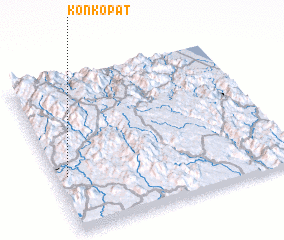 Places with similar names to Kon Kơpat, Vietnam ::
Disclaimer :: Information on this page comes without warranty of any kind |
||
|
Where is Kon Kơpat? Elevation and coordinates ::
Latitude (lat): 14°22'0"N Longitude (lon): 108°3'0"E
Elevation (approx.): 544m (map arrows pan, magnifying glasses zoom) |
||
|
Visiting Kon Kơpat? Hotel/Accommodation ::
Book a hotel in Kon Kơpat Travel Guide ::
Buy a travel guide for Vietnam rental cars ::
car rental offers GPS waypoint ::
download a GPX waypoint (PoI) of Kon Kơpat for your GPS receiver
|
||