|
search place name
|
||
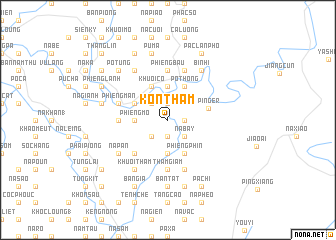
Kôn Thâm (Lạng Sơn, Vietnam)Kôn Thâm is a town in the Lạng Sơn region of Vietnam. An overview map of the region around Kôn Thâm is displayed below.
regional and 3d topo map of Kôn Thâm, Vietnam ::
Kôn Thâm airports ::
The nearest airport is HAN - Hanoi Noibai Intl, located 137.4 km south west of Kôn Thâm.
Other airports nearby include NNG - Nanning Wuxu (162.6 km east), Nearby towns ::
Na Man (1) (1.9km north) //
Na Thông (1.7km east) //
Ðâng Săm (1.9km south) //
Co Ca (2.5km north west) //
Na Sang (2.5km north west) //
Na Bay (2.5km south east) //
Khuôi Siu (2.5km south west) //
Phiêng Cang (1) (3.7km north) //
Bản Pen (3.4km west) //
Phiêng Mo (3.4km west) //
Co Lũng (3.7km south) //
Po Thong (4.1km north east) //
Khuôi Cổ (4.1km north west) //
Bản Tâu (4.1km north west) //
Công Luông (3.9km north west) //
Na Thòng (4.1km south east) //
Phiêng Phin (4.1km south east) //
Ping'er (4.3km east) //
Ðông Sân (5.1km south west) //
Cuc Mương (5.1km west) //
Co Cao (5.1km west) //
Thâm Giầm (5.6km south) //
Hin Ðeng (5.6km south) //
Phiêng Bàu (5.6km north) //
Phiêng Mân (5.5km west) //
Na Na (5.5km west) //
Nà Hỏi (5.8km north) //
Bản Tả (5.8km south) //
Khôn Ngọa (5.8km south) //
[all distances 'as the bird flies' and approximate] 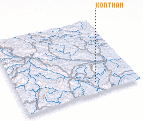
Disclaimer :: Information on this page comes without warranty of any kind |
||
|
Where is Kôn Thâm? Elevation and coordinates ::
Latitude (lat): 22°10'0"N Longitude (lon): 106°40'0"E
Elevation (approx.): 155m (map arrows pan, magnifying glasses zoom) |
||
|
Visiting Kôn Thâm? Hotel/Accommodation ::
Book a hotel in Kôn Thâm Travel Guide ::
Buy a travel guide for Vietnam rental cars ::
car rental offers GPS waypoint ::
download a GPX waypoint (PoI) of Kôn Thâm for your GPS receiver
|
||