|
search place name
|
||
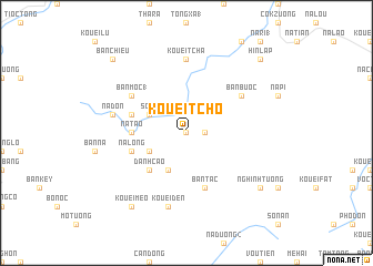
Kouei Tcho (Bắc Thái, Vietnam)Kouei Tcho is a town in the Bắc Thái region of Vietnam. An overview map of the region around Kouei Tcho is displayed below.
regional and 3d topo map of Kouei Tcho, Vietnam ::
Kouei Tcho airports ::
The nearest airport is HAN - Hanoi Noibai Intl, located 81.3 km south of Kouei Tcho.
Nearby towns ::
Phien Dien (0.0km north) //
Mo Dong (2) (1.7km east) //
Kouei Xóm (3.9km south west) //
So Ta (3.9km north west) //
Bản Chuong (4.1km south west) //
Danh Cao (5.1km south west) //
Na Tao (5.2km west) //
Bản Moc (2) (5.2km west) //
Na Long (5.5km west) //
Bản Tinh (1) (5.5km west) //
Na Hin (5.5km west) //
Bản Tac (5.8km south) //
Bản Buoc (6.4km north east) //
Bản Moc (1) (6.4km north west) //
Kouei Tcha (7.4km north) //
Kouei Den (7.6km south) //
Na Don (7.1km west) //
Kouei Meo (9.0km south west) //
Nghinh Tường (8.8km south east) //
Hin Lap (10.1km north east) //
Bản Chieu (10.1km north west) //
[all distances 'as the bird flies' and approximate] 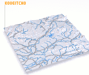 Places with similar names to Kouei Tcho, Vietnam ::
Disclaimer :: Information on this page comes without warranty of any kind |
||
|
Where is Kouei Tcho? Elevation and coordinates ::
Latitude (lat): 21°56'0"N Longitude (lon): 106°0'0"E
Elevation (approx.): 371m (map arrows pan, magnifying glasses zoom) |
||
|
Visiting Kouei Tcho? Hotel/Accommodation ::
Book a hotel in Kouei Tcho Travel Guide ::
Buy a travel guide for Vietnam rental cars ::
car rental offers GPS waypoint ::
download a GPX waypoint (PoI) of Kouei Tcho for your GPS receiver
|
||