|
search place name
|
||
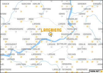
Làng Biêng (Vietnam)Làng Biêng is a town in Vietnam. An overview map of the region around Làng Biêng is displayed below.
regional and 3d topo map of Làng Biêng, Vietnam ::
Làng Biêng airports ::
The nearest airport is HAN - Hanoi Noibai Intl, located 70.5 km north east of Làng Biêng.
Nearby towns ::
Làng Tháu (1.9km south) //
Làng Nưa (2.5km south west) //
Làng Voi (3.7km south) //
Làng Vach (3.5km east) //
Làng Mó (3.9km north west) //
Làng Diâm (3.9km north west) //
Lang Trương (3.9km south west) //
Làng Re (5.1km north east) //
Quỳnh Lâm (5.1km south east) //
Làng Nàng (5.2km west) //
Phương Lâm (5.2km east) //
Làng Mai (5.5km west) //
Làng Chà (5.5km west) //
Hòa Bình (5.7km east) //
Lương Thân (6.6km south west) //
Làng Trai (6.6km south west) //
Làng Hai (6.4km north west) //
Bay Chuyên (6.4km south west) //
Xóm Chang (6.4km south east) //
Làng Mõ (7.4km south) //
Làng Ngu (7.2km west) //
Thinh Làng (7.2km east) //
Phương Lâm (7.2km east) //
Xóm Lón (7.6km south west) //
Tư Lý (8.2km north west) //
Ngănh Trê (7.9km south west) //
Xóm Nè (8.2km north east) //
Bến Ngọc (7.9km north east) //
Xóm Gioc Khoi (7.9km south east) //
[all distances 'as the bird flies' and approximate] 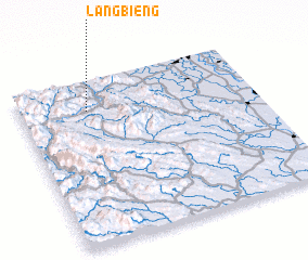 Places with similar names to Làng Biêng, Vietnam ::
// Lingbong (PH)
// Long Banga (MY)
// Long Buang (MY)
// Long Buang (MY)
// Lungbunga (GH)
// Langbank (CA)
// Làng Bang (VN)
// Làng Bang (VN)
// Làng Băng (VN)
// Làng Băng (VN)
Disclaimer :: Information on this page comes without warranty of any kind |
||
|
Where is Làng Biêng? Elevation and coordinates ::
Latitude (lat): 20°49'0"N Longitude (lon): 105°17'0"E
Elevation (approx.): 476m (map arrows pan, magnifying glasses zoom) |
||
|
Visiting Làng Biêng? Hotel/Accommodation ::
Book a hotel in Làng Biêng Travel Guide ::
Buy a travel guide for Vietnam rental cars ::
car rental offers GPS waypoint ::
download a GPX waypoint (PoI) of Làng Biêng for your GPS receiver
|
||