|
search place name
|
||
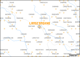
Làng Cống Khê (Thanh Hóa, Vietnam)Làng Cống Khê is a town in the Thanh Hóa region of Vietnam. An overview map of the region around Làng Cống Khê is displayed below.
regional and 3d topo map of Làng Cống Khê, Vietnam ::
Làng Cống Khê airports ::
The nearest airport is HAN - Hanoi Noibai Intl, located 134.1 km north of Làng Cống Khê.
Nearby towns ::
Hương Ngọc Lac (0.6km north east) //
Ngọc Khê (1.7km east) //
Cam Ngu (1.9km north) //
Làng Sat (1.9km north) //
Xóm Than (3.5km west) //
Làng Su (3.9km north east) //
Cam Chàng (4.1km north east) //
Làng Mót (5.1km south east) //
Mông Sơn (5.5km east) //
Cam Dao (5.8km north) //
Làng Tich (5.8km south) //
Làng Mên (6.6km south east) //
Cam Sơn (6.6km north west) //
Làng Ðá (7.4km south) //
Làng Ro (7.2km east) //
Cam Ruong (7.6km north east) //
Làng Mương (7.6km south east) //
Cam Ðẵm (7.9km south west) //
Làng Giẻ (9.1km south west) //
Ngọc Diền (8.9km north east) //
[all distances 'as the bird flies' and approximate]  Places with similar names to Làng Cống Khê, Vietnam :: Disclaimer :: Information on this page comes without warranty of any kind |
||
|
Where is Làng Cống Khê? Elevation and coordinates ::
Latitude (lat): 20°5'0"N Longitude (lon): 105°22'0"E
Elevation (approx.): 58m (map arrows pan, magnifying glasses zoom) |
||
|
Visiting Làng Cống Khê? Hotel/Accommodation ::
Book a hotel in Làng Cống Khê Travel Guide ::
Buy a travel guide for Vietnam rental cars ::
car rental offers GPS waypoint ::
download a GPX waypoint (PoI) of Làng Cống Khê for your GPS receiver
|
||