|
search place name
|
||
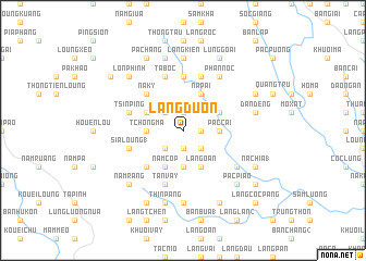
Làng Ðuôn (Cao Bằng, Vietnam)Làng Ðuôn is a town in the Cao Bằng region of Vietnam. An overview map of the region around Làng Ðuôn is displayed below.
regional and 3d topo map of Làng Ðuôn, Vietnam ::
Làng Ðuôn airports ::
The nearest airport is HAN - Hanoi Noibai Intl, located 175.4 km south of Làng Ðuôn.
Nearby towns ::
Làng Ri (1) (1.9km north) //
Lủng Hình (1.7km east) //
Làng Mần (1.9km south) //
Làng May (2.5km north west) //
Coc Houng (2.5km south east) //
Làng Pản (2.5km south east) //
Phia Khao (2.5km south west) //
Phô Trung Thảng (2.5km south east) //
Pác Cai (3.4km east) //
Làng Tản (3.7km south) //
Tchong Ma (3.4km west) //
Bản Giàng (3.9km north east) //
Nà Pài (4.1km north east) //
Năm Cốp (4.1km south west) //
Cốc Chia (4.1km south east) //
Làng Oàn (4.1km south east) //
Làng Gioung (4.1km south east) //
Páo Ngàm (3.9km north west) //
Cốc Chia (3.9km north west) //
Nà Kỳ (5.0km north west) //
Coc Tcha (5.0km south west) //
Ché Cà (5.6km north) //
No Leou Ping (5.4km west) //
Tsin Ping (5.4km west) //
Làng Siang (5.5km west) //
Sia Loung (1) (5.5km west) //
Nà Bó (5.8km north) //
Ta Bốc (5.8km north) //
Tan Vầy (5.8km south) //
[all distances 'as the bird flies' and approximate]  Places with similar names to Làng Ðuôn, Vietnam ::
Disclaimer :: Information on this page comes without warranty of any kind |
||
|
Where is Làng Ðuôn? Elevation and coordinates ::
Latitude (lat): 22°48'0"N Longitude (lon): 105°57'0"E
Elevation (approx.): 347m (map arrows pan, magnifying glasses zoom) |
||
|
Visiting Làng Ðuôn? Hotel/Accommodation ::
Book a hotel in Làng Ðuôn Travel Guide ::
Buy a travel guide for Vietnam rental cars ::
car rental offers GPS waypoint ::
download a GPX waypoint (PoI) of Làng Ðuôn for your GPS receiver
|
||