|
search place name
|
||
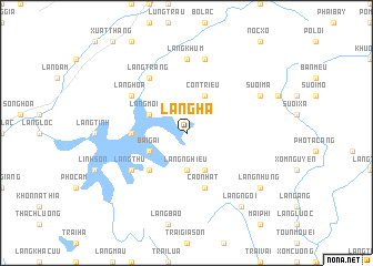
Làng Hạ (Hà Bắc, Vietnam)Làng Hạ is a town in the Hà Bắc region of Vietnam. An overview map of the region around Làng Hạ is displayed below.
regional and 3d topo map of Làng Hạ, Vietnam ::
Làng Hạ airports ::
The nearest airport is HAN - Hanoi Noibai Intl, located 93.1 km south west of Làng Hạ.
Other airports nearby include NNG - Nanning Wuxu (197.4 km north east), Nearby towns ::
Làng Nghiêu (3.7km south) //
Con Triêu (4.1km north east) //
Làng Cha (4.1km south east) //
Làng Mong (3.9km north west) //
Bai Gai (3.9km south west) //
Làng Héo (5.1km south west) //
Làng Man (5.2km west) //
Cao Nhất (5.8km south) //
Làng Hoa (6.4km north west) //
Ðông Sơn (6.4km north west) //
Làng Com (6.4km north west) //
Làng Thu (6.4km south west) //
Làng Trang (6.5km north west) //
Làng Khùm (7.4km north) //
Hap Cay (7.6km north) //
Khuôn Bông (7.8km north east) //
Suối Mạ (7.8km north east) //
Làng Ngoi (9.0km south east) //
Làng Nhưng (8.9km south east) //
[all distances 'as the bird flies' and approximate] 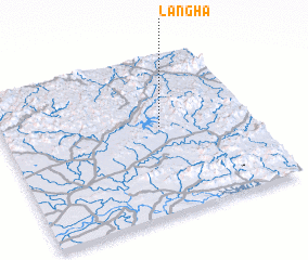 Places with similar names to Làng Hạ, Vietnam ::
Disclaimer :: Information on this page comes without warranty of any kind |
||
|
Where is Làng Hạ? Elevation and coordinates ::
Latitude (lat): 21°33'0"N Longitude (lon): 106°38'0"E
Elevation (approx.): 75m (map arrows pan, magnifying glasses zoom) |
||
|
Visiting Làng Hạ? Hotel/Accommodation ::
Book a hotel in Làng Hạ Travel Guide ::
Buy a travel guide for Vietnam rental cars ::
car rental offers GPS waypoint ::
download a GPX waypoint (PoI) of Làng Hạ for your GPS receiver
|
||