|
search place name
|
||
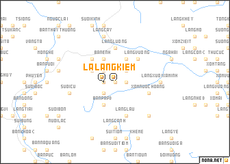
Làng Kiem (Vietnam)Làng Kiem is a town in Vietnam. An overview map of the region around Làng Kiem is displayed below.
regional and 3d topo map of Làng Kiem, Vietnam ::
Làng Kiem airports ::
The nearest airport is HAN - Hanoi Noibai Intl, located 108.1 km east of Làng Kiem.
Nearby towns ::
Bản Ðung (0.0km north) //
Quang Huy (0.0km north) //
Làng Trinh (1.7km east) //
Xóm Băng (1.7km east) //
Làng Chiet (1.7km west) //
Làng Kiem (1.7km west) //
Làng San (2.5km north east) //
Bản Pap (2) (2.5km south west) //
Làng Mo (2.5km north west) //
Làng Khey So (4.1km north east) //
Bản Pap (1) (4.1km south west) //
Bản Enh (4.1km north west) //
Bản Ca (4.1km north west) //
Mương Lang (3.9km north west) //
Núi Ong (3.9km north west) //
Làng Vuong (5.1km north east) //
Bản Ban (2) (5.1km north west) //
Làng Lương (5.6km north) //
Làng Lâu (5.8km south) //
Xóm Nước Hoang (5.5km east) //
Làng Xuối Xa Minh (6.9km east) //
Làng Canh (7.4km south) //
Suối Cù (7.2km west) //
Làng Cây (7.6km north) //
Bản Suối Hang (7.6km south east) //
[all distances 'as the bird flies' and approximate] 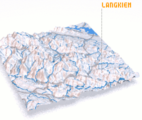 Places with similar names to Làng Kiem, Vietnam ::
// Long-Agomey (BJ)
// Lungkam (IN)
// Laangkumbe (ID)
// Lankagama (LK)
// Làng Cam (VN)
// Làng Cam (VN)
// Làng Cam (VN)
// Làng Côm (VN)
// Làng Com (VN)
// Làng Cuom (VN)
Disclaimer :: Information on this page comes without warranty of any kind |
||
|
Where is Làng Kiem? Elevation and coordinates ::
Latitude (lat): 21°15'0"N Longitude (lon): 104°46'0"E
Elevation (approx.): 302m (map arrows pan, magnifying glasses zoom) |
||
|
Visiting Làng Kiem? Hotel/Accommodation ::
Book a hotel in Làng Kiem Travel Guide ::
Buy a travel guide for Vietnam rental cars ::
car rental offers GPS waypoint ::
download a GPX waypoint (PoI) of Làng Kiem for your GPS receiver
|
||