|
search place name
|
||
Làng Pậu Mai (Vietnam)Làng Pậu Mai is a town in Vietnam. An overview map of the region around Làng Pậu Mai is displayed below.
regional and 3d topo map of Làng Pậu Mai, Vietnam ::

Làng Pậu Mai airports ::
The nearest airport is HAN - Hanoi Noibai Intl, located 176.6 km south east of Làng Pậu Mai.
Nearby towns ::
Gia Mải (1.9km north) //
Nàm Xit (2.5km north west) //
Làng Mai (3.7km north) //
Gôc Diệp (4.1km north west) //
Làng Chuân (5.1km west) //
Bản Thau (5.1km east) //
Pac Khouang (5.5km west) //
Nậm Hoắc (6.5km north west) //
Làng Ken (6.5km south east) //
Làng Khuàng (6.9km west) //
Làng Pang (6.9km west) //
Làng Miễu (7.4km south) //
Làng Khao (7.6km north) //
Bảo Yên (7.6km south west) //
Cốc Ðiệp (7.6km north west) //
Làng Khoa (8.2km south west) //
Bản Piac (7.8km south east) //
Bản Cánh (7.8km south east) //
Làng Măc (8.2km north west) //
Làng Lư (9.0km south west) //
Bản Bang (10.1km south east) //
[all distances 'as the bird flies' and approximate] 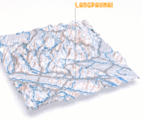 Places with similar names to Làng Pậu Mai, Vietnam ::
// Làng Pam (VN)
// Long Pó Moi (VN)
Disclaimer :: Information on this page comes without warranty of any kind |
||
|
Where is Làng Pậu Mai? Elevation and coordinates ::
Latitude (lat): 22°17'0"N Longitude (lon): 104°32'0"E
Elevation (approx.): 143m (map arrows pan, magnifying glasses zoom) |
||
|
Visiting Làng Pậu Mai? Hotel/Accommodation ::
Book a hotel in Làng Pậu Mai Travel Guide ::
Buy a travel guide for Vietnam rental cars ::
car rental offers GPS waypoint ::
download a GPX waypoint (PoI) of Làng Pậu Mai for your GPS receiver
|
||