|
search place name
|
||
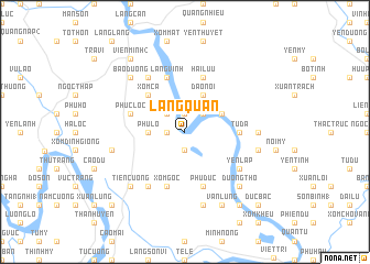
Làng Quán (Vĩnh Phú, Vietnam)Làng Quán is a town in the Vĩnh Phú region of Vietnam. An overview map of the region around Làng Quán is displayed below.
regional and 3d topo map of Làng Quán, Vietnam ::
Làng Quán airports ::
The nearest airport is HAN - Hanoi Noibai Intl, located 52.1 km south east of Làng Quán.
Nearby towns ::
Nhân Mục (1.9km north) //
Lỗ Chì (1.7km west) //
Phù Ninh (1.9km south) //
Xóm Tri (2.5km north west) //
Yên Ðạo (2.5km north east) //
Phú Lỗ (3.5km west) //
Trinh Nữ (3.9km north east) //
Khoan Bộ (3.9km north east) //
Ðạo Nội (4.1km north east) //
Xóm Cả (5.1km north west) //
Tử Ðà (5.2km east) //
Bình Sơn (5.2km east) //
Bình Bộ (5.2km east) //
Phức Lộc (5.5km west) //
Làng Vinh (5.8km north) //
Xóm Gôc (5.8km south) //
Bạch Lưu (5.8km north) //
Phù Ðức (5.8km south) //
Hải Lưu (5.8km north) //
Hạ Giáp (6.5km north west) //
Cổ Tich (6.5km south west) //
Yên Lập (6.4km south east) //
Ðông Ðạo (6.9km east) //
Cành Phú (7.1km west) //
Phú Nặng (7.6km south) //
Nhu Sơn (7.1km east) //
Bảo Ðường (7.6km north west) //
Tiên Cương (7.6km south west) //
An Lão (7.6km south east) //
[all distances 'as the bird flies' and approximate] 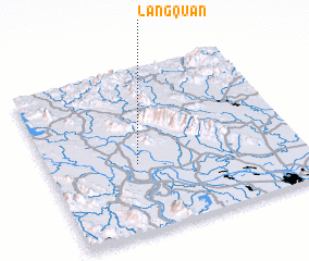 Places with similar names to Làng Quán, Vietnam ::
Disclaimer :: Information on this page comes without warranty of any kind |
||
|
Where is Làng Quán? Elevation and coordinates ::
Latitude (lat): 21°25'0"N Longitude (lon): 105°21'0"E
Elevation (approx.): 13m (map arrows pan, magnifying glasses zoom) |
||
|
Visiting Làng Quán? Hotel/Accommodation ::
Book a hotel in Làng Quán Travel Guide ::
Buy a travel guide for Vietnam rental cars ::
car rental offers GPS waypoint ::
download a GPX waypoint (PoI) of Làng Quán for your GPS receiver
|
||