|
search place name
|
||
Lão Van Tchai (Vietnam)Lão Van Tchai is a town in Vietnam. An overview map of the region around Lão Van Tchai is displayed below.
regional and 3d topo map of Lão Van Tchai, Vietnam ::

Lão Van Tchai airports ::
The nearest airport is HAN - Hanoi Noibai Intl, located 247.7 km south east of Lão Van Tchai.
Nearby towns ::
Phìn Ngan (1.7km west) //
Tchao Tou Kia (2.5km south west) //
Lao Toang (3.4km east) //
Tchong Ho (3.4km east) //
Lao Pan Tchai (3.7km south) //
Sung Bang (3.9km north east) //
Lo Sui Tong (3.9km south east) //
Ly Ta (3.9km south east) //
Sin Tchay (4.1km south east) //
Pan Pho (4.1km south west) //
Phìn Hồ (4.1km south west) //
Yen Tang (5.6km south) //
Ngai Tcho (5.5km west) //
Loung Giang (5.5km east) //
Ngài Chồ (5.5km west) //
Pán Pò (5.5km west) //
Bản Pho (5.5km west) //
Sin Tchai (6.3km north west) //
Ba Tsiao Pin (6.3km north west) //
Pa Cheo (6.3km north west) //
Trung Chải (6.5km south east) //
Lao Chải (6.3km south west) //
Mông Hóa (6.3km south west) //
Ta Yang Ping (6.3km south west) //
Bản Khoang (6.5km south west) //
Ping Ho (1) (6.5km south west) //
Ta Li (6.9km east) //
Tai Yang Pin (6.9km west) //
Nậm Pung (6.9km west) //
[all distances 'as the bird flies' and approximate] 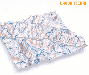 Places with similar names to Lão Van Tchai, Vietnam ::
// Lão Van Tchay (VN)
Disclaimer :: Information on this page comes without warranty of any kind |
||
|
Where is Lão Van Tchai? Elevation and coordinates ::
Latitude (lat): 22°28'0"N Longitude (lon): 103°49'0"E
Elevation (approx.): 1052m (map arrows pan, magnifying glasses zoom) |
||
|
Visiting Lão Van Tchai? Hotel/Accommodation ::
Book a hotel in Lão Van Tchai Travel Guide ::
Buy a travel guide for Vietnam rental cars ::
car rental offers GPS waypoint ::
download a GPX waypoint (PoI) of Lão Van Tchai for your GPS receiver
|
||