|
search place name
|
||
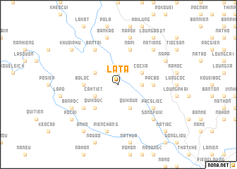
La Ta (Cao Bằng, Vietnam)La Ta is a town in the Cao Bằng region of Vietnam. An overview map of the region around La Ta is displayed below.
regional and 3d topo map of La Ta, Vietnam ::
La Ta airports ::
The nearest airport is HAN - Hanoi Noibai Intl, located 139.4 km south west of La Ta.
Other airports nearby include NNG - Nanning Wuxu (187.7 km east), Nearby towns ::
Na Phai (1.9km north) //
Bản Ca (3.4km east) //
Coc Xa (3.9km north east) //
Khuối Som (3.9km north west) //
Qui Kou (1) (4.1km south east) //
Cam Tiet (3.9km south west) //
Qui Kou (2) (5.0km south west) //
Pac Bo (5.1km east) //
Bo Loc (5.1km west) //
Na Pi (5.8km north) //
Bản Tai (6.5km north west) //
Cok Ton (6.3km south east) //
Pac Sliec (6.3km south east) //
Bak Dap (6.3km south west) //
Na Po (1) (7.6km north) //
Bản Kao (7.6km north) //
Quang Liệt (7.6km north) //
Pien Chang (7.6km south) //
Na Tiang (7.6km north east) //
Song Fuik (7.6km south east) //
Na Ngaun (7.8km north east) //
Na Pa (7.8km north east) //
Bản Po (2) (7.8km south west) //
Loung Bout (9.0km north east) //
An Mo (9.0km south west) //
Po Cai (8.8km south west) //
Khuối Phu (8.8km north west) //
Na Tiac (10.1km south east) //
[all distances 'as the bird flies' and approximate] 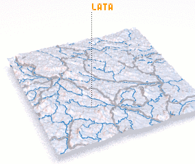 Places with similar names to La Ta, Vietnam ::
Disclaimer :: Information on this page comes without warranty of any kind |
||
|
Where is La Ta? Elevation and coordinates ::
Latitude (lat): 22°22'0"N Longitude (lon): 106°22'0"E
Elevation (approx.): 308m (map arrows pan, magnifying glasses zoom) |
||
|
Visiting La Ta? Hotel/Accommodation ::
Book a hotel in La Ta Travel Guide ::
Buy a travel guide for Vietnam rental cars ::
car rental offers GPS waypoint ::
download a GPX waypoint (PoI) of La Ta for your GPS receiver
|
||