|
search place name
|
||
Lễ Ðô (Hà Bắc, Vietnam)Lễ Ðô is a town in the Hà Bắc region of Vietnam. An overview map of the region around Lễ Ðô is displayed below.
regional and 3d topo map of Lễ Ðô, Vietnam ::

Lễ Ðô airports ::
The nearest airport is HAN - Hanoi Noibai Intl, located 41.0 km west of Lễ Ðô.
Other airports nearby include NNG - Nanning Wuxu (257.8 km north east), Nearby towns ::
Yên Tập Núi (1.9km north) //
Ða Thinh Sơn (2.5km south west) //
Ðông Viên (2.5km south east) //
Thọ Thôn (3.5km east) //
Phù Lương (3.7km south) //
Phấn Lôi (3.9km south east) //
Bằng Lâm (3.9km south west) //
Hương Tảo (3.9km north east) //
Hiền Luong (4.1km south east) //
Bến Thôn (3.9km north west) //
Yên Ðiệm (3.9km north west) //
Ðồng Tế (5.1km south east) //
Nghiêm Xá (5.1km south west) //
Quê Dương (5.1km south west) //
Ðồng Chuế (5.2km west) //
Làng Biểu (5.2km east) //
Phấn Sơn (5.6km north) //
Ðông Du (5.6km south) //
Hà Liễu (5.5km west) //
Thông Thiên (5.5km west) //
Dũng Quyết (5.8km south) //
Châu Cầu (6.5km south east) //
Giang Thon (6.5km north east) //
Phung D (6.5km south east) //
Thanh Cam (6.5km north east) //
Yén Trach (6.4km south east) //
Bến Thôn (6.4km south east) //
Phương Mao (6.4km south west) //
Bình An (6.5km north west) //
[all distances 'as the bird flies' and approximate] 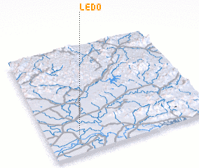 Places with similar names to Lễ Ðô, Vietnam ::
Disclaimer :: Information on this page comes without warranty of any kind |
||
|
Where is Lễ Ðô? Elevation and coordinates ::
Latitude (lat): 21°11'0"N Longitude (lon): 106°12'0"E
Elevation (approx.): 7m (map arrows pan, magnifying glasses zoom) |
||
|
Visiting Lễ Ðô? Hotel/Accommodation ::
Book a hotel in Lễ Ðô Travel Guide ::
Buy a travel guide for Vietnam rental cars ::
car rental offers GPS waypoint ::
download a GPX waypoint (PoI) of Lễ Ðô for your GPS receiver
|
||