|
search place name
|
||
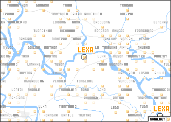
Lê Xá (Hải Hưng, Vietnam)Lê Xá is a town in the Hải Hưng region of Vietnam. An overview map of the region around Lê Xá is displayed below.
regional and 3d topo map of Lê Xá, Vietnam ::
Lê Xá airports ::
The nearest airport is HAN - Hanoi Noibai Intl, located 69.4 km west of Lê Xá.
Other airports nearby include NNG - Nanning Wuxu (247.9 km north east), Nearby towns ::
Ninh Xá (0.0km north) //
Trạm Lô (2.5km north east) //
Thái Mông (2.5km south west) //
An Bộ (2.5km south east) //
Xạ Sơn (2.5km south west) //
Vũ Xá (3.5km east) //
Vĩnh Lâm (3.5km east) //
Ðộng Mai (3.7km north) //
Trì Giả (3.9km south east) //
Quang Trí (3.9km south east) //
Tân Áp (4.1km north west) //
Lâu Dộng (3.9km south west) //
Ðai Thôn (5.2km west) //
Tống Long (5.6km south) //
Lạc Sơn (5.5km west) //
Triều Khê (5.5km east) //
Nghĩa Lộ (5.5km east) //
Mạo Khê (5.5km west) //
Tế Sơn (5.5km west) //
Trung Hòa (5.8km south) //
Ðạm Thủy (6.4km north east) //
Ninh Trấp (6.4km north west) //
Bằng Sơn (6.5km north east) //
Ðích Sơn (6.5km south east) //
Chi Diên (6.4km south west) //
Bìch Nham (6.5km north west) //
Vĩnh Trụ (6.9km west) //
Kệ Sơn (6.9km east) //
Bộ Hổ (7.4km south) //
[all distances 'as the bird flies' and approximate] 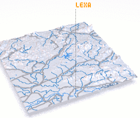 Places with similar names to Lê Xá, Vietnam ::
Disclaimer :: Information on this page comes without warranty of any kind |
||
|
Where is Lê Xá? Elevation and coordinates ::
Latitude (lat): 21°3'0"N Longitude (lon): 106°27'0"E
Elevation (approx.): 6m (map arrows pan, magnifying glasses zoom) |
||
|
Visiting Lê Xá? Hotel/Accommodation ::
Book a hotel in Lê Xá Travel Guide ::
Buy a travel guide for Vietnam rental cars ::
car rental offers GPS waypoint ::
download a GPX waypoint (PoI) of Lê Xá for your GPS receiver
|
||