|
search place name
|
||
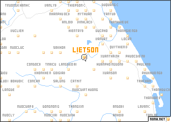
Liệt Sơn (Vietnam)Liệt Sơn is a town in Vietnam. An overview map of the region around Liệt Sơn is displayed below.
regional and 3d topo map of Liệt Sơn, Vietnam ::
Liệt Sơn airports ::
The nearest airport is DAD - Danang Intl, located 163.4 km north west of Liệt Sơn.
Nearby towns ::
Làng Sa Khom (1.9km north) //
Làng Sa Lung (2.6km north west) //
Làng Go Ai (2.6km south east) //
Thủy Thạch (3) (3.6km east) //
Làng Deo Ai (4.0km south west) //
Văn Vật (5.2km north east) //
Hoa Thành (5.2km north east) //
Xuân Thành (5.4km east) //
Mỹ Trang (4) (5.4km east) //
An Ðiền (5.8km north) //
Cat Mit (5.8km south) //
An Tây (5.8km north) //
Hiên Tây (1) (5.8km north) //
Huân Phong Ðồn (1) (5.7km east) //
Làng Ðồng Ban (2) (5.7km west) //
Mỹ Trang (1) (5.7km east) //
Sa Khom (5.7km west) //
Xuân Sơn (6.5km south east) //
Goi Gia (1) (6.5km south west) //
An Thương (1) (6.6km north east) //
Ðức Phổ (6.6km north east) //
Nga Mận (7.2km east) //
Nước Bo (7.4km south) //
Nước Dip Thượng (7.4km south) //
Vĩnh Lạc (3) (7.4km north) //
Thanh Lâm (1) (7.4km north) //
Trai Cu (7.4km west) //
Nước Tên (7.4km west) //
Làng Goi Gia (7.4km west) //
[all distances 'as the bird flies' and approximate] 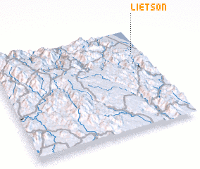 Places with similar names to Liệt Sơn, Vietnam ::
Disclaimer :: Information on this page comes without warranty of any kind |
||
|
Where is Liệt Sơn? Elevation and coordinates ::
Latitude (lat): 14°45'0"N Longitude (lon): 108°56'0"E
Elevation (approx.): 49m (map arrows pan, magnifying glasses zoom) |
||
|
Visiting Liệt Sơn? Hotel/Accommodation ::
Book a hotel in Liệt Sơn Travel Guide ::
Buy a travel guide for Vietnam rental cars ::
car rental offers GPS waypoint ::
download a GPX waypoint (PoI) of Liệt Sơn for your GPS receiver
|
||