|
search place name
|
||
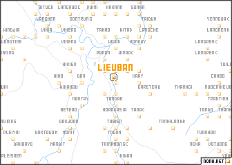
Liêu Bần (Vietnam)Liêu Bần is a town in Vietnam. An overview map of the region around Liêu Bần is displayed below.
regional and 3d topo map of Liêu Bần, Vietnam ::
Liêu Bần airports ::
The nearest airport is DAD - Danang Intl, located 126.2 km north of Liêu Bần.
Nearby towns ::
Boba (0.0km north) //
Plei Leo (3) (0.0km north) //
Dak Kia (1.9km north) //
Tadai (1.9km south) //
Pho Tu (1.9km south) //
Plei Leo (1) (2.6km south west) //
Kakeo (2.6km north west) //
Tich Niên (2.6km north west) //
Làng Kiem (1) (2.6km north east) //
Nongam (3.7km south) //
Tangam (3.7km south) //
Làng Lay (3.7km south) //
Xà Ây (3.6km east) //
Kuan (4.1km north west) //
Gòranh (4.1km north west) //
Long Trem (4.1km north west) //
Pakan (4.1km north west) //
Cam Ly (4.1km north west) //
Wi Rao (2) (4.1km north east) //
Làng Kiem (2) (4.1km north east) //
Làng Mon (3) (4.0km north east) //
Dan (5.4km west) //
Hoan Kasia (5.6km south) //
Galan (2) (5.6km south) //
Wi Go (1) (5.6km north) //
Tà Mac (5.6km north) //
Gareteau (5.7km east) //
Mantay (6.5km south west) //
Tà Ma (2) (6.6km south east) //
[all distances 'as the bird flies' and approximate] 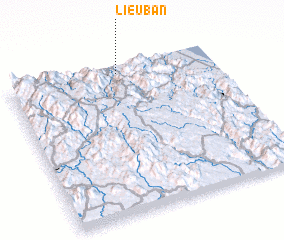 Places with similar names to Liêu Bần, Vietnam ::
Disclaimer :: Information on this page comes without warranty of any kind |
||
|
Where is Liêu Bần? Elevation and coordinates ::
Latitude (lat): 14°57'0"N Longitude (lon): 108°32'0"E
Elevation (approx.): 122m (map arrows pan, magnifying glasses zoom) |
||
|
Visiting Liêu Bần? Hotel/Accommodation ::
Book a hotel in Liêu Bần Travel Guide ::
Buy a travel guide for Vietnam rental cars ::
car rental offers GPS waypoint ::
download a GPX waypoint (PoI) of Liêu Bần for your GPS receiver
|
||